


CLEVELAND — There is a low marginal risk for a few strong to severe storms in our area. Additionally, flood warnings and advisories have been issued. The best chance for storms will be down around Akron, Canton and New Philadelphia, where rain and storms are building now moving Northeast.
A strong thunderstorm is expected to impact Cuyahoga, Portage, Trumbull, Geauga, Ashtabula and Summit counties between 9 p.m. and 10 p.m.
Warnings and advisories
Current weather warning and advisory map:

A Flood Advisory has been issued until 10:15 p.m. for Medina County and 11:30 p.m. for Cuyahoga and Lake counties.
There is a River Flood Warning for the Black River at Elyria in Lorain County in effect until 10:24 a.m. Wednesday. More details here.
A Marine Warning has been issued until 10:15 p.m. for Lake, Cuyahoga and Ashtabula counties.
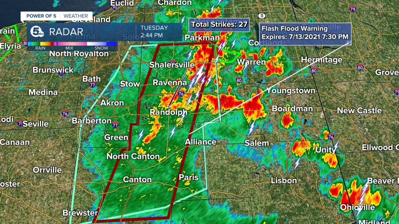
At about 2:15 p.m., Power of 5 Meteorologist Remeisha Shade gave an update on heavy rain and strong storms rolling through parts of Northeast Ohio. Watch a replay below:
Impacts
A few additional flooding issues could develop, although storm movement is a bit quicker today, so that will help some. Heavy rain, frequent lightning and a few strong wind gusts are possible with today's storms. The best shot will be until around 9 p.m. or sunset, when storms should start to fade.
Forecast headlines
- Warm & muggy
- Few more storms Tuesday
- Some with heavy rain
- 80s this week
- Daily storm chances thru Friday
- Keep the rain gear handy
Radar and current conditions:
Current Conditions
- Humidity: 74%
- Dew point: 36°
- Pressure: 29.97 in
- Wind speed: 14 mph
- Wind direction: SSE
- Visibility: 10.0 mi
- Sunrise: 07:30 AM
- Sunset: 07:39 PM
Rest of the week
Storms are expected to be less widespread Wednesday and Thursday as we add more heat, according to the Power of 5 Weather Team.
After a stormy Friday, we finally begin to dry out just in time for the weekend.
Stick with the Power of 5 Weather Team and stay up to date with the latest weather.
Want the latest Power of 5 weather team updates wherever you go? Download the News 5 App free now: Apple|Android
Download the StormShield app for weather alerts on your iOS and Android device: Apple|Android
Click here to view our interactive radar.
Read and watch the latest Power of 5 forecast here.
Follow the News 5 Weather Team:
Mark Johnson: Facebook & Twitter
Remeisha Shade: Facebook & Twitter
Trent Magill: Facebook & Twitter
Katie McGraw: Facebook & Twitter
