


Don't let today's sun, heat and humidity throw you off; the big focus is on the thunderstorms. It's all fuel for the storms. Strong storms. The threat of damage was elevated this evening.
The Power of 5 was live throughout the evening and into Thursday night as they tracked downpours and storms.
WATCH:
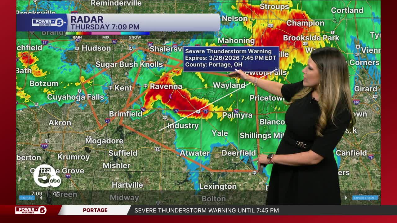
Weather alerts
Check here for the latest severe weather alerts.
What to expect
This evening will be an evolving situation, starting out with a tornado and large hail threat. These storms will be building along the lakeshore around 5 p.m. Expect individual thunderstorms and discrete supercells.
Those storms will have rotating updrafts, meaning they'll have the energy to support hail over 1 inch in diameter and tornadoes.
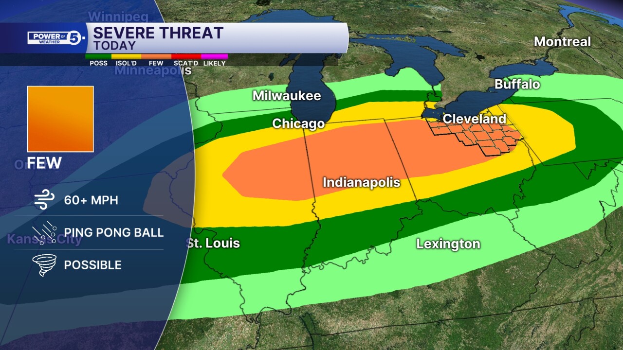
Those storms continue to grow and eventually form a line of thunderstorms. A squall line. That threat for large hail and tornadoes will drop at that point, but the threat for wind damage will go up.
This will be more widespread and cause more power outages across Northeast Ohio.

This line should slide into southern Ohio and weaken overnight. As that line slides out, waves of heavy rain linger. That means the flood threat will be elevated.

The heaviest rain will linger into Friday morning.
Flood-prone areas south of Route 30 should be on alert for flash flooding.

Stay informed
The Power of 5 Weather Team will be streaming these storms on-air and across all our platforms. Be sure to check them out on YouTube, Facebook, Roku and our app.
Want the latest Power of 5 weather team updates wherever you go? Download the News 5 App free now: Apple|Android
Click here to view our interactive radar.
Follow the News 5 Weather Team:
Trent Magill: Facebook & Twitter
Katie McGraw: Facebook & Twitter
Phil Sakal: Facebook & Twitter
Allan Nosoff: Facebook & Twitter
