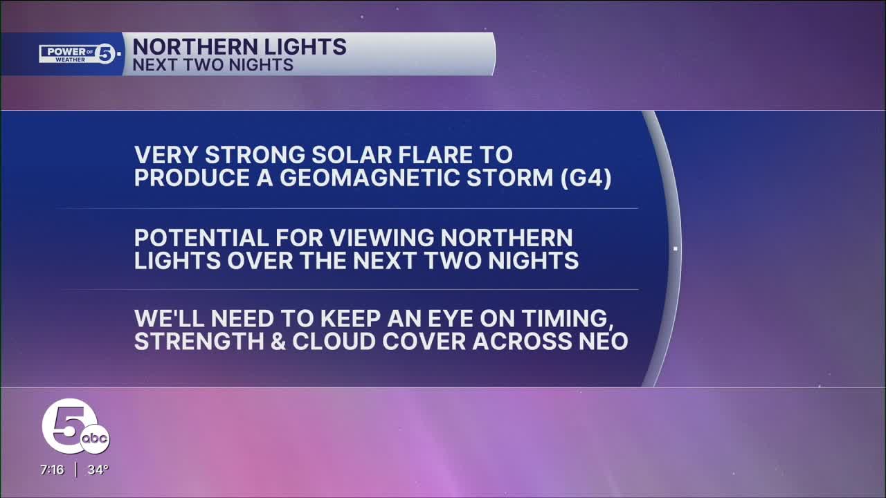


The National Weather Service Space Weather Prediction Center has issued a G4 or Severe Geomagnetic Storm Watch. This is a level four out of five on the alert scale.
A G4 storm usually results in a geomagnetic K-index over 7, but could reach 8 or 9. For us to see the northern lights across NEO, typically a Kp of at least 7 is needed.

The strongest part of the storm/best chance to see the northern lights is expected tonight and Thursday. This watch was issued due to coronal mass ejections or CMEs that have erupted from the Sun over the past several days.
When CMEs arrive at Earth, geomagnetic storms are the result. The most recent CME occurred early on Tuesday and is the most energetic and fastest of the CMEs. This intense cluster of energy was directed straight at Earth.
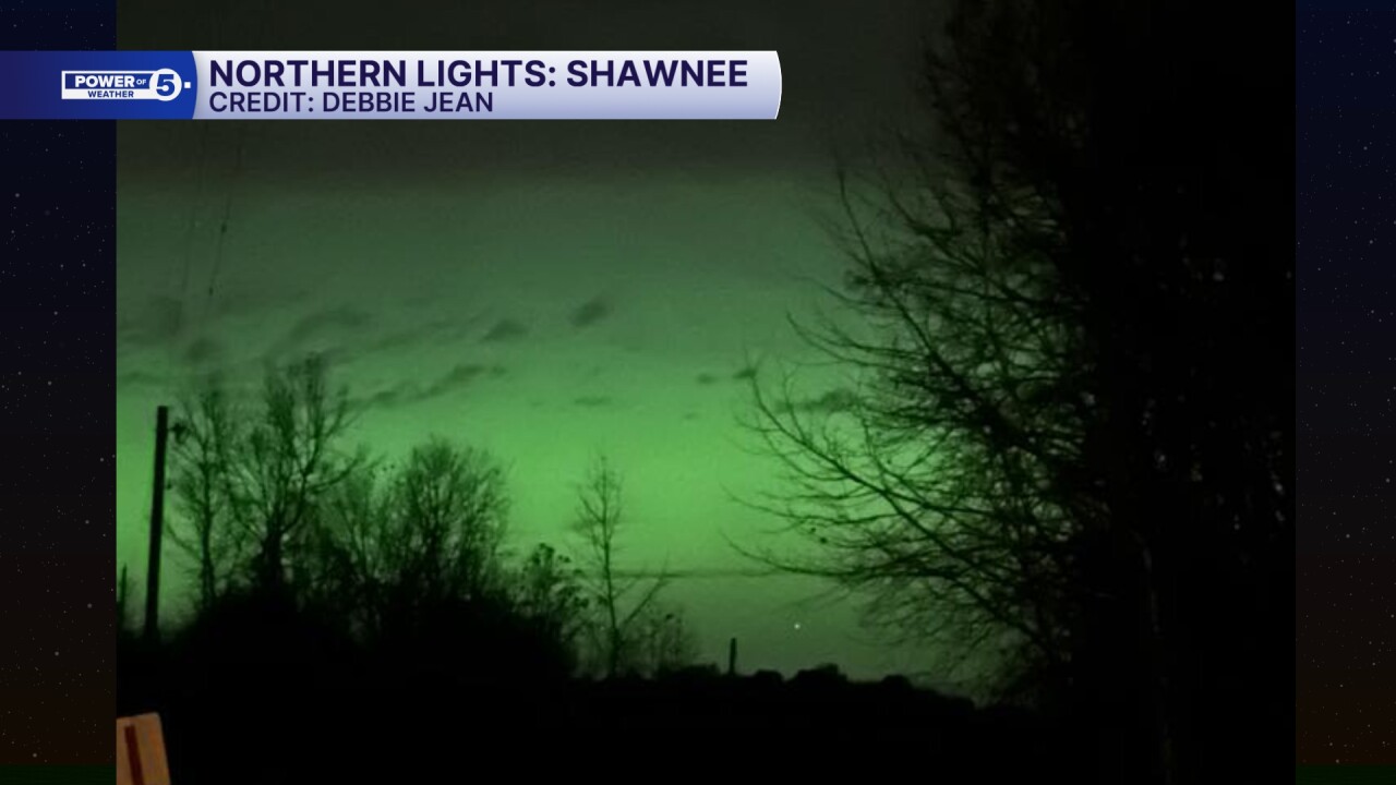
This is a lot of mumbo jumbo to say that northern lights will be visible for at least the northern half of the U.S. and may be seen as far south as Alabama. There are reports of Aurora Borealis being spotted across the U.S. on Tuesday night as far south as New Mexico!
Unfortunately, NEO is still battling some clouds. Clouds are going to try to clear overnight, especially farther south, but clouds will be tougher to clear both Tuesday night and Wednesday night in our northeastern communities.
I think it is still worth a look both nights, since this is such a strong storm. Remember, to look north to see the lights (or toward the lake), be patient, and use your phone to get a better view.


Here are a few pictures of the Northern lights that have been spotted across southern and western Ohio Tuesday evening.


Want the latest Power of 5 weather team updates wherever you go? Download the News 5 App free now: Apple|Android
Click here to view our interactive radar.
Follow the News 5 Weather Team:
Trent Magill: Facebook & Twitter
Katie McGraw: Facebook & Twitter
Phil Sakal: Facebook & Twitter
Allan Nosoff: Facebook & Twitter
