


CLEVELAND — With parts of Northeast Ohio still dealing with the aftermath of Wednesday’s severe weather, soaring heat will fuel more waves of storms Thursday and Friday, with a few more strong to severe storms possible and the potential for damaging wind gusts and heavy rain.
The National Weather Service in Cleveland said that severe thunderstorms are again expected for much of the area this afternoon and evening, with the potential for damaging wind gusts over 70 MPH, heavy rainfall and localized flooding.
The risk of severe thunderstorms is slight across most of Northeast Ohio, with an enhanced threat in the southeast. Expect more watches and warnings to come soon.
Severe thunderstorms are once again expected for much of the area this afternoon and evening. Damaging wind gusts in excess of 70 MPH are possible along with very heavy rainfall causing localized flooding. Stay tuned for possible watches and warnings. pic.twitter.com/iddWGmWxtm
— NWS Cleveland (@NWSCLE) August 12, 2021
Meteorologist Katie McGraw provided a live update on today's weather at around 10:40 a.m.:
Weather Alerts
A Severe Thunderstorm Warning has been issued for Tuscarawas and Carroll counties until 10 p.m.
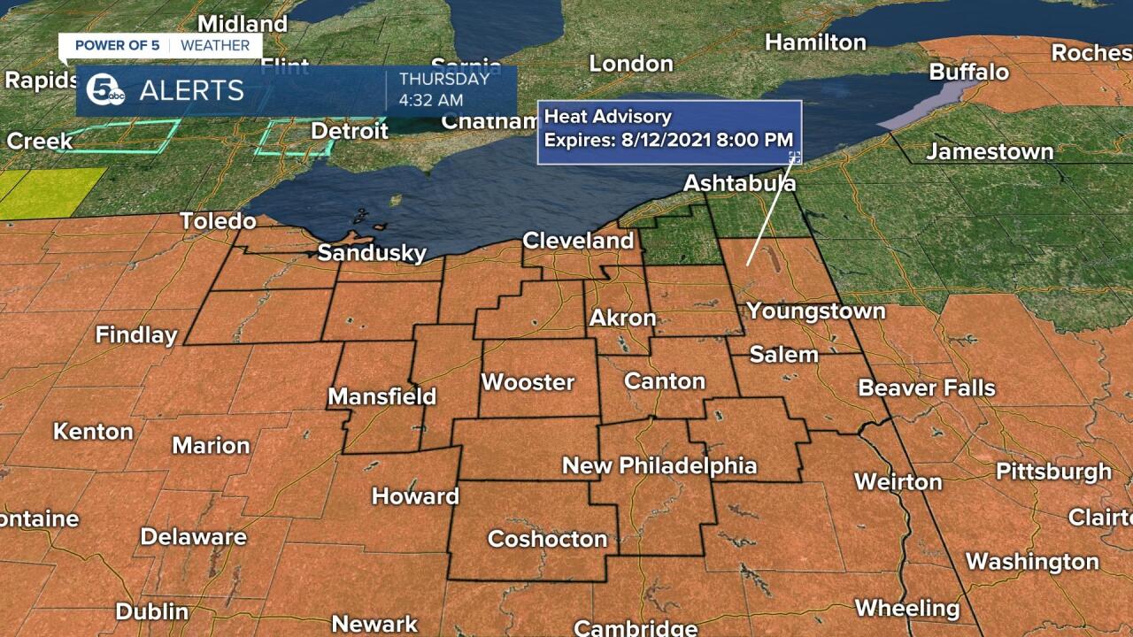
Most counties in Northeast Ohio are under a Heat Advisory from 12 p.m. to 8 p.m. Thursday, with heat index values up to 100 expected, according to the National Weather Service. Hot temperatures and high humidity may cause heat illnesses to occur.
The NWS advises: “Drink plenty of fluids, stay in an air-conditioned room, stay out of the sun, and check up on relatives and neighbors. Young children and pets should never be left unattended in vehicles under any circumstances. Take extra precautions if you work or spend time outside. When possible reschedule strenuous activities to early morning or evening. Know the signs and symptoms of heat exhaustion and heat stroke. Wear lightweight and loose fitting clothing when possible. To reduce risk during outdoor work, the Occupational Safety and Health Administration recommends scheduling frequent rest breaks in shaded or air conditioned environments. Anyone overcome by heat should be moved to a cool and shaded location. Heat stroke is an emergency!”
Any additional weather alerts issued Thursday will appear in the map below:

See more details on the latest weather alerts in our area here.
More storms coming, strong to severe possible
Waves of storms remain in the forecast through Friday. A few of these storms could be strong to severe with potentially damaging wind gusts and heavy rain leading to flash flooding.
MORE STORMS: Much of NE Ohio is dry this morning, but if you live closer to the lakeshore, be aware of heavy rain and gusty storms. West of Cleveland, storms are scattered. East of Cleveland, a line of gusty storms is moving inland off the lake.#CLE #News5 #weather pic.twitter.com/kJFoJqkXrf
— Katie McGraw (@KatieMcGrawx) August 12, 2021

Cooler and drier air finally rolls back in by the weekend.
See the latest Power of 5 Forecast here.
Area still recovering from Wednesday’s storms
Thousands are still without power, and roads and buildings are closed across the area due to downed trees and other damage left by the severe thunderstorms that rolled through Wednesday.
See the latest power outage, road closure and damage reports here.
Want the latest Power of 5 weather team updates wherever you go? Download the News 5 App free now: Apple|Android
Download the StormShield app for weather alerts on your iOS and Android device: Apple|Android
Click here to view our interactive radar.
Read and watch the latest Power of 5 forecast here.
Follow the News 5 Weather Team:
Mark Johnson: Facebook & Twitter
Remeisha Shade: Facebook & Twitter
