


CLEVELAND — Let's be real. Monday's snow totals were a shock. The impacts were not shocking to anyone but the totals... Those were substantially higher than expected for a lot of us. That being said, this is in no way a justification for the error, but there's always something to learn with any mistake.
To prevent this from being 1,000 words long and incredibly confusing by comparing low position and strength, temperatures over the lower 5,000 feet of the atmosphere, dew point, wind direction, Lake Erie water temps and much more, I'm only going to show model snowfall output. It's the easier "less accurate" way to forecast the snow for anyone with a basic knowledge of Googling weather models. It's what you see all over the internet from "social media-rologists" that partake in what I call "model vomit" in the days leading up to a snowstorm.
RELATED: How Monday's snowstorm compares to the 1978 blizzard
That being said, there is a ton to learn from only these maps. The first is from five days before the storm. Notice the sharp cutoff in snow totals from Columbus to Cleveland. Peep those numbers, too.
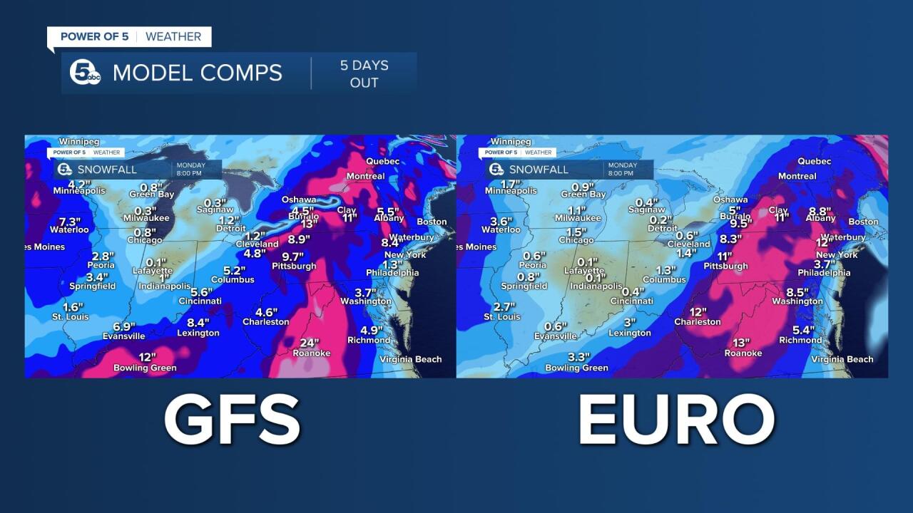
Now check those same models the next day, four days before the storm was expected to roll in — GFS still thinks it's all staying east while the Euro adds 6 inches to Cleveland. That's significant. The consistent thing is still that cutoff line.

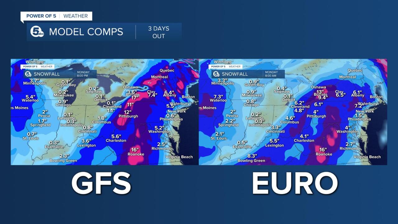
Three days out and the GFS is still way east. Actually, farther east now. Euro still sticking to 6-ish inches for Cleveland. Both have that cutoff line.
Whoa... two days out, Euro steps up the game. GFS still clueless but consistently clueless. We didn't know it was clueless though so we couldn't throw it out. GFS is very certain Cleveland will not have significant snow. Euro disagrees, consistently.

Now we're one day out. GFS hasn't budged. Euro not only didn't budge but just went all in. Cleveland 12 inches? That's something we get once every seven years, climatologically speaking. If we're going to put something like that on-air, we better have some sort of agreement between the models, right? You bet.

Now, I'm not sharing my thoughts to justify the error. I mean, here's my forecast from four days out that I showed on Good Morning Cleveland.
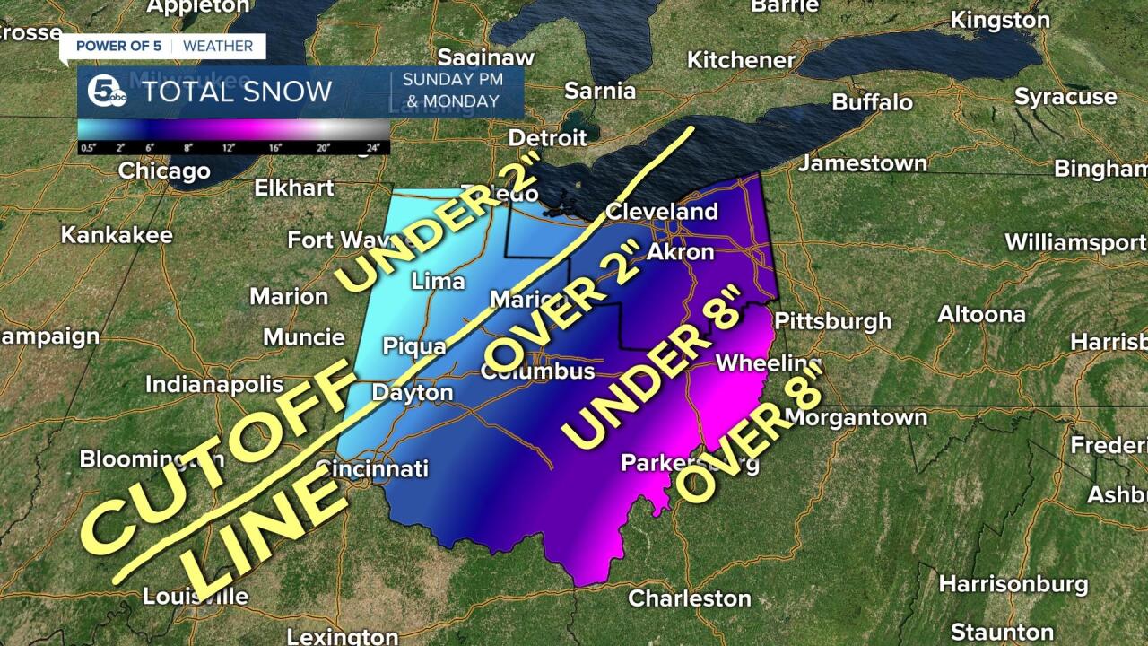
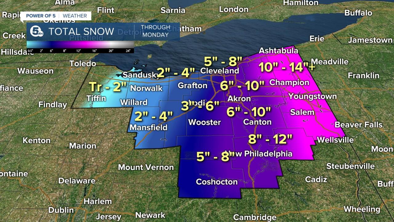
Check out the cutoff line. I was confident in that. I was not confident in the snow numbers, though. We narrowed in on the numbers through the weekend, and I posted this map the day before.
Like I said above, every miss only helps your progress, if you learn from it. That's why I always go back and check "what I missed." To answer that question, it was a 5-degree temp drop from midnight to 6 a.m. and a 20-mile shift in the track of the low the night of the storm.
RELATED: Here's how much snow we got
