


A cold front is moving through Northeast Ohio over the next day. Before the front brings the return of much cooler temperatures, it will also bring strong storms tonight, accompanied by widespread rain on Thursday. This rain could be heavy at times, which could lead to flooding. Stay weather aware over the next 24 hours!
- A severe thunderstorm warning has been issued for Summit, Stark, and Portage Counties until 1:45 am for wind speeds of 60 mph and small hail. This storm also contains heavy rain.
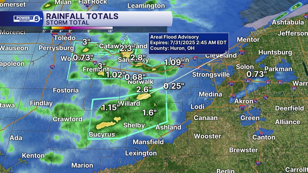
- A flood advisory has also been issued for Richland, Ashland, and Huron counties following strong and severe storms that dropped 1 to 1.5 inches of rain. Minor flooding is expected in the area. The advisory remains in effect until 2:45 am.
- A previously issued flood advisory for Ottawa, Erie, and Sandusky counties expired at midnight after the storms continued to push east.
Additional storms are moving into western Ohio. We will continue to watch these as they continue to move east into our viewing area. The next few hours have the highest potential for storms to become strong or severe— especially across northwestern Ohio.
TIMING: However, storms do not end there. We are just getting started. Overnight storms will be spreading out from west to east and from north to south. By tomorrow morning, the majority of NEO will be waking up to wet weather. It will take the longest to make it to our southern communities, resulting in lower rainfall amounts.
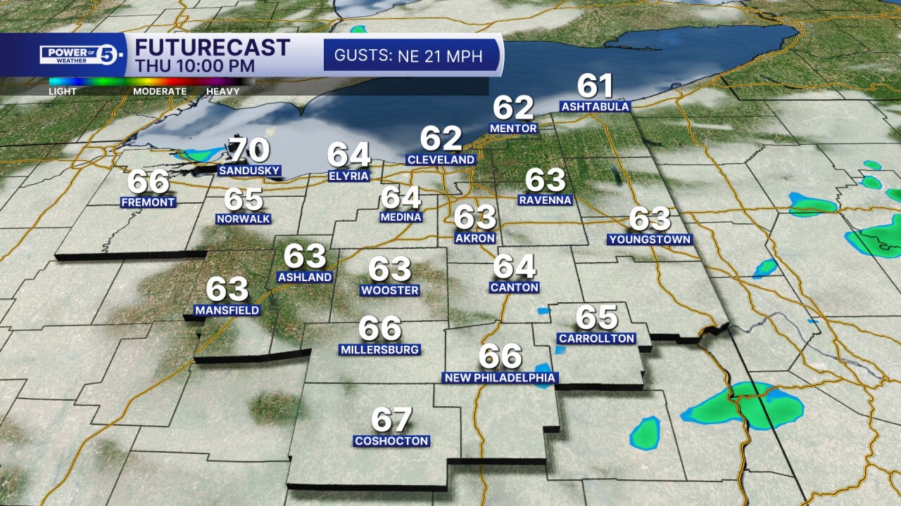
There will be periods and pockets of heavy rain on Thursday, especially during the first half of the day. Plan for widespread rain Thursday morning and afternoon, with a very gradual drying trend by Thursday evening and lighter showers. By Thursday night, it looks MUCH drier. Friday only has an isolated chance for a shower or two.
Scroll through the images of Futurecast below to get a better idea of the timing and coverage of rain and storms over the next day. Be sure to check the timestamp in the banner in each image.
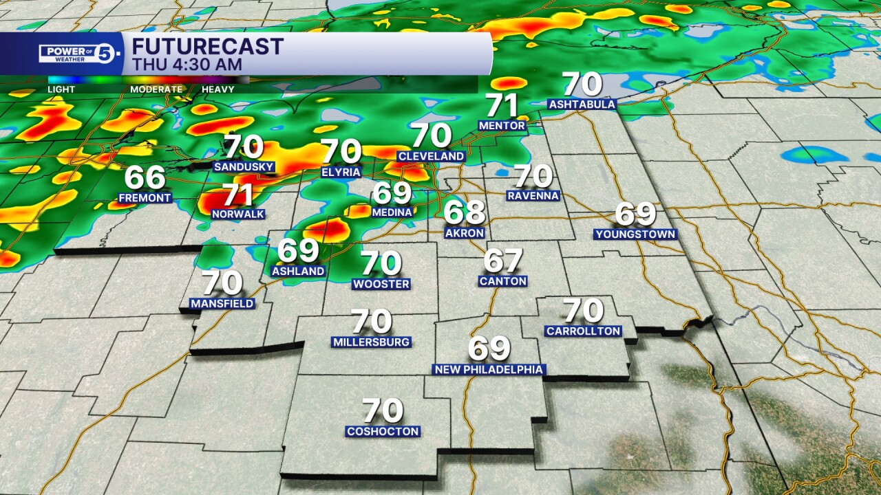
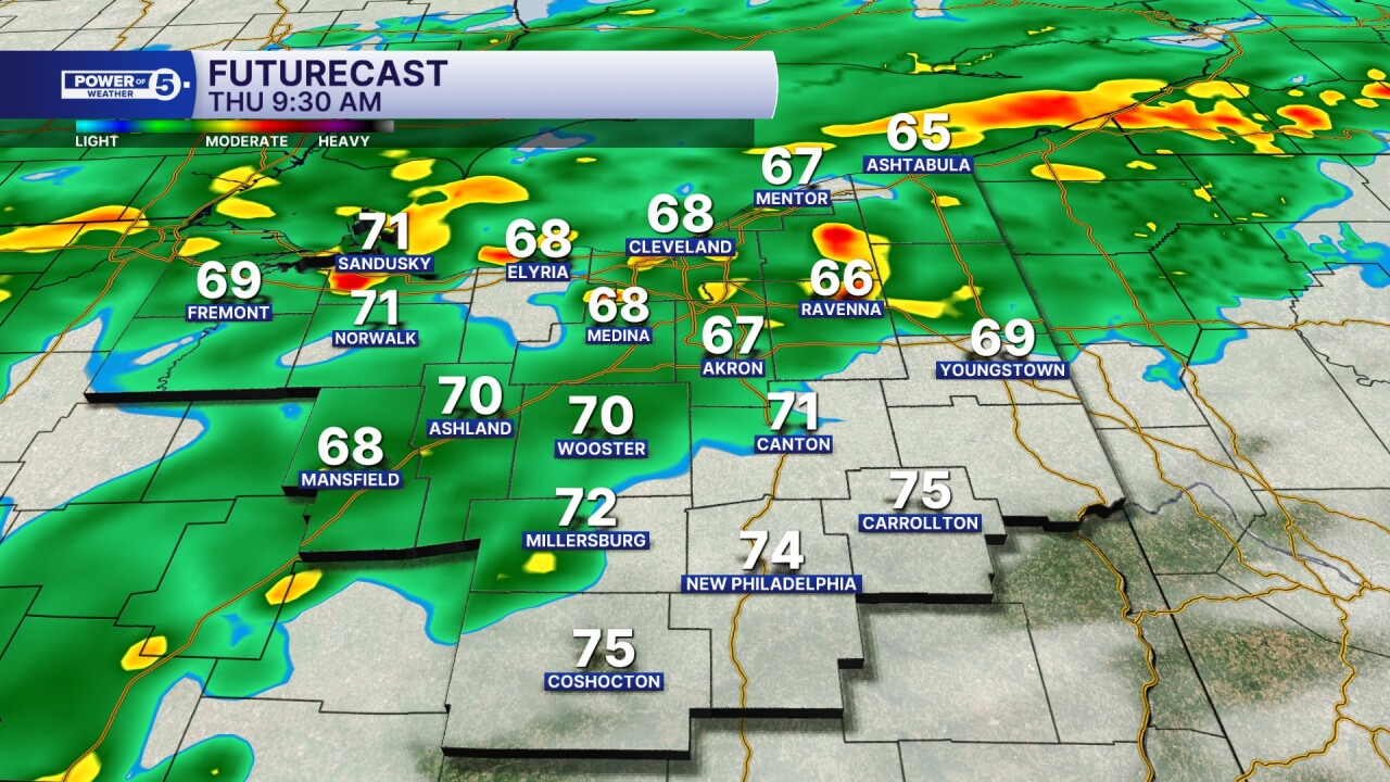
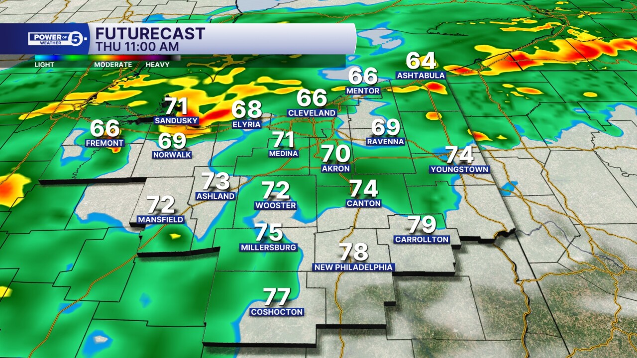
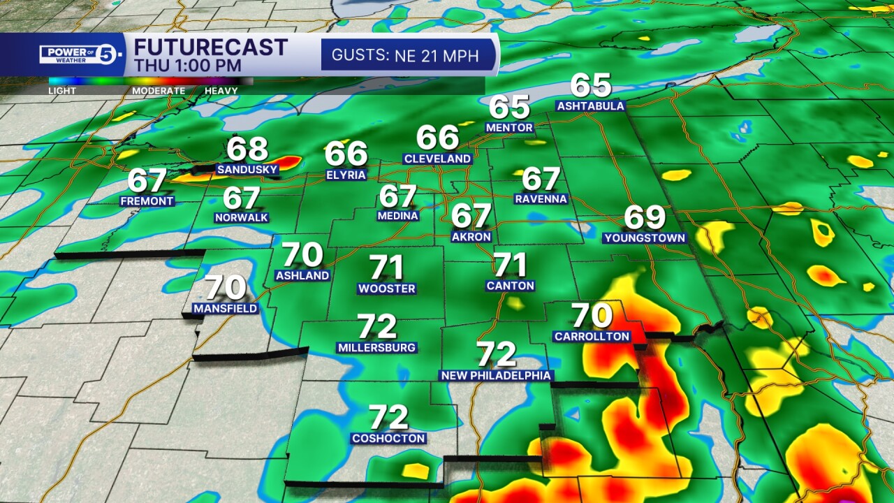
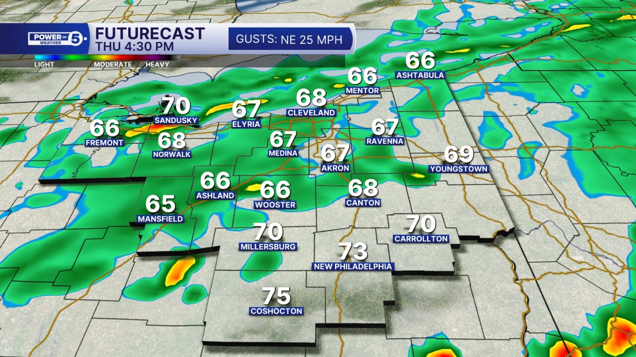
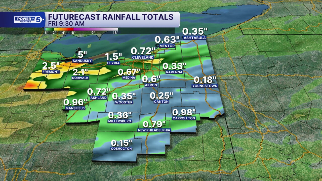
TOTALS: The biggest concern on Thursday will be excessive rainfall that could lead to flooding. By the end of Thursday, our northern and western communities will likely pick up around 0.5 to 2 inches of rain, with lower amounts farther east and southeast, where 0.25 to 1.5 inches of rain is more likely.
However, some communities could easily see over 3 inches of rain due to repeated rounds of heavy rain. As mentioned above, flood advisories have already be issued this evening from storms that dumped 1 to 3 inches of rain.
Flooding will continue to be a concern, especially early on Thursday. Turn around, don't drown when encountering flooded roads.
Want the latest Power of 5 weather team updates wherever you go? Download the News 5 App free now: Apple|Android
Download the StormShield app for weather alerts on your iOS and Android device: Apple|Android
Click here to view our interactive radar.
Read and watch the latest Power of 5 forecast here.
Follow the News 5 Weather Team:
Trent Magill: Facebook & Twitter
Katie McGraw: Facebook & Twitter
Phil Sakal: Facebook & Twitter
