


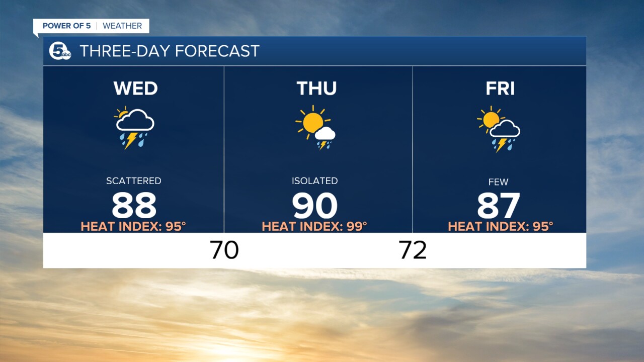
CLEVELAND — Storms are fading this morning, but more heat and intense humidity are fueling another round of afternoon storms.
Power of 5 meteorologist Remeisha Shade gave an update on what to expect the rest of the day. Watch it in the media player below:
The afternoon round will start around 3 p.m. Winds in excess of 30 mph are expected.
Once the storms pass through our area, temperatures will skyrocket, reaching back up to the mid-90s. This afternoon's storms may cut the daytime heat short, though. Plan on storms building 2-4 p.m. and getting out of here around 6-8 p.m.
Warnings and Advisories
A Flood Advisory has been issued for Erie, Huron and Richland counties until 3:00 p.m.
Between one to three inches of rain have fallen in these areas.
If you encounter flooded roads, the NWS is advising "you to turn around, don’t drown. Most flood deaths occur in vehicles."
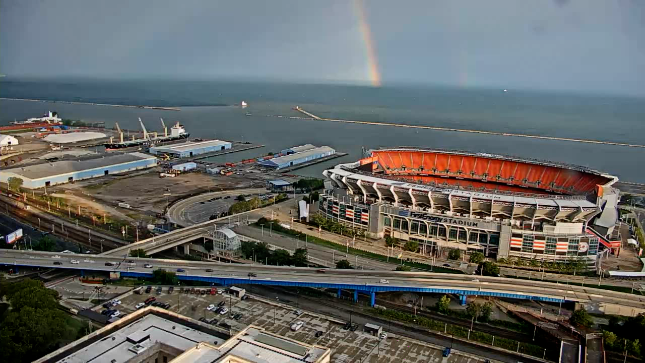
Yes, that was a double rainbow this morning
Our camera from the Hilton grabbed this shot from over the stadium and the lake this morning.
Weather footage
News 5 photojournalist Mike Vielhaber captured a lightning show off Lake Erie near the North Coast Harbor Wednesday at around 1 a.m.
A little video showing the light show as round 1 passes through. https://t.co/2ZuE6Xu8gz pic.twitter.com/DaAskpLTFp
— Mike Vielhaber (@MVielhaber) August 25, 2021
Want the latest Power of 5 weather team updates wherever you go? Download the News 5 App free now: Apple|Android
Download the StormShield app for weather alerts on your iOS and Android device: Apple|Android
Click here to view our interactive radar.
Read and watch the latest Power of 5 forecast here.
Follow the News 5 Weather Team:
Mark Johnson: Facebook & Twitter
Remeisha Shade: Facebook & Twitter
