

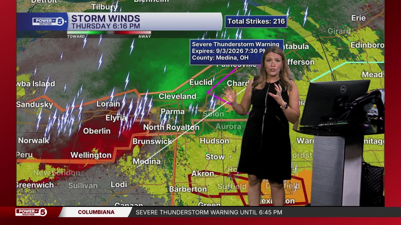


CLEVELAND — Stay weather-aware through the end of the workweek! The risk of severe storms has ended for Thursday. However, additional storms that could become strong or severe are possible again on Friday.
ALERTS: A Flood advisory for Portage and Summit Counties will expire at 11:00 pm. A flash flood warning for Carroll County will expire at 10:45 pm. A Tornado Warning issued earlier for Cuyahoga, Lake, and Geauga counties has expired. The severe thunderstorm watch has been canceled for the entire viewing area.
News 5 Meteorologist Allan Nosoff was near the lake and captured a spectacular shelf cloud this afternoon:
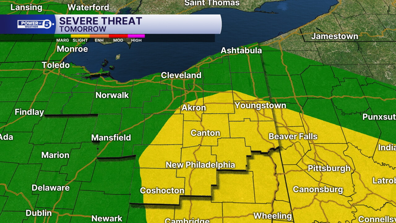
SEVERE RISK:
The Storm Prediction Center has posted severe weather risks again for Friday. All of NEO has the potential for strong or severe storms, but the highest potential is in the Akron-Canton and South Regions. The area in yellow is a level 2 out of 5 on the SPC's scale. The green is a level 1 out of 5.
MAIN THREATS:
Damaging winds and large hail are the main threats with any storm; however, repeated rounds of heavy rain could lead to localized flooding concerns. Isolated tornadoes are not off the table either. Remember that any storm can be dangerous when lightning is present. When thunder roars, get indoors!
TIMING:
Unfortunately, exact timing and storm placement have been very tricky to predict all week long. That is true again on Friday. At this time, it looks like we could see two rounds of storms. One in the mid- to late-morning until mid-afternoon and another round Friday night into early Saturday morning.
Since this forecast is evolving, please check back for the latest updates, including whether and when severe storms develop. Stay safe and weather-aware! Be sure to have a way to get warnings!
Radar
View the current Power of 5 Weather Radar below:
Power outages
As of 6:39 p.m., about 10,000 customers across Northeast Ohio are without power, with nearly 7,000 in Cuyahoga County.
Visit our Power Outage page to find links to see current power outages in Northeast Ohio and to report a power outage.
Traffic impacts
View our News 5 Traffic Map to see any road closures or delays caused by weather or crashes.
Send us photos, videos and reports of the weather
Please stay safe! Do not put yourself in danger to get a photo or video of severe weather.
You can send us photos and short videos by filling out the form below:
Want the latest Power of 5 weather team updates wherever you go? Download the News 5 App free now: Apple|Android
Click here to view our interactive radar.
Follow the News 5 Weather Team:
Trent Magill: Facebook & Twitter
Katie McGraw: Facebook & Twitter
Phil Sakal: Facebook & Twitter
Allan Nosoff: Facebook & Twitter
