


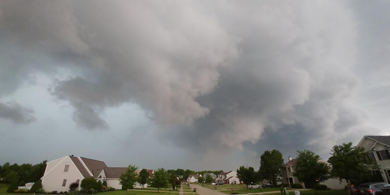
Most of Northeast Ohio was hit with severe weather on Wednesday. Thunderstorms developed across the area Wednesday afternoon and continued through the evening. Fifty-four reports of severe weather were reported to the National Weather Service in Cleveland across the region. Most of the reports were from damaging wind gusts causing power outages and tree damage.
STORM REPORTS:
STARK COUNTY: Social media pictures show several medium to large tree limbs down, as well as several trees with pea to dime size hail in Massillon. Another tree was downed east of Canton.
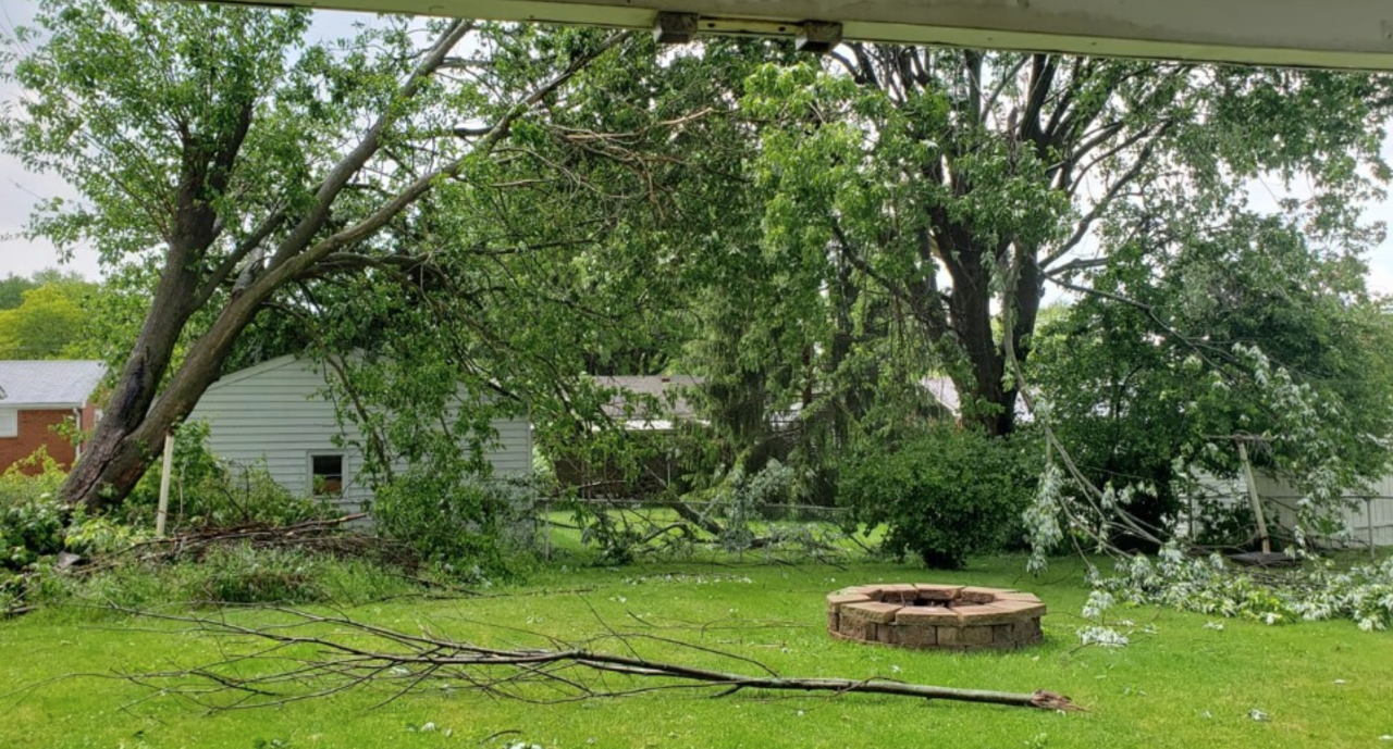
SUMMIT COUNTY: A tree was down on Riverview Road, south of Everett. Another tree was downed in a backyard. The tree split and fell on a power line. Numerous trees were reported to be down at Hudson Springs Park. One inch of hail was reported in Hudson. Multiple trees were snapped and power lines downed.
We’re getting a look at the damage from severe storms in Hudson last night. The city tells me no injuries were reported @WEWS pic.twitter.com/99REanDsns
— Catherine Ross (@CatherineRossTV) June 2, 2022
LORAIN COUNTY: Strong winds resulted in many reports of downed trees. Two trees were reported to be on houses in Lorain and Sheffield. Another tree fell on power lines and a car on East River Road in Sheffield Village. Trees and power lines were reported to be down to the southeast of Elyria. Small hail was also reported across the county.
WAYNE COUNTY: A tree was knocked down along RT 83 just to the north of Wooster. Strong wind gusts were reported across the county.
PORTAGE COUNTY: A 70 mph wind gust was reported, along with 1 inch of hail in Streetsboro. A tree was uprooted in Shalersville Township.
RICHLAND COUNTY: The fire department reported several electrical poles were downed across SR 96 east of Shelby between Plymouth-Springmill Road and Industrial Tech Parkway.
HOLMES COUNTY: A tree fell onto power lines in Benton at the intersection of SR 241 and County Road 189.
SANDUSKY COUNTY: Four power poles were down on US RT 6 and County Road 294. A person was trapped in car in between the poles - but was thankfully not injured.
SENECA COUNTY: Many trees downed across Venice Township, power lines were downed on the north side of Fostoria. Additionally, Seneca County dispatch reported trees down on a building near TR 172 and CR 25 to the north of Fostoria. Once inch of hail was reported near Bettsville, along with 60 mph wind gusts. A few more trees were down in Republic and Big Spring Township.
TRUMBULL COUNTY: Widespread tree and power line damage across the county.
MAHONING COUNTY: Multiple trees and wires were reported down.

PEAK WIND GUSTS:
Streetsboro: 70 mph
North Royalton: 60 mph
Stow: 55 - 60 mph
Sandusky: 43 mph
Vermilion: 43 mph
Smithville: 53 mph
Viewer photos and videos of Wednesday's storms
Strongsville
Photo courtesy of Julie Kiste.

Brunswick
Photo courtesy of Mai Lavelle.
Massillon
Video courtesy of Karen LeMasters.
Picture courtesy of Adam Lambert
Lorain
Video courtesy of Lewis Rosa.
Picture courtesy of Richard Perez:

Want the latest Power of 5 weather team updates wherever you go? Download the News 5 App free now: Apple|Android
Download the StormShield app for weather alerts on your iOS and Android device: Apple|Android
Click here to view our interactive radar.
Read and watch the latest Power of 5 forecast here.
Follow the News 5 Weather Team:
Mark Johnson: Facebook & Twitter
Remeisha Shade: Facebook & Twitter
