


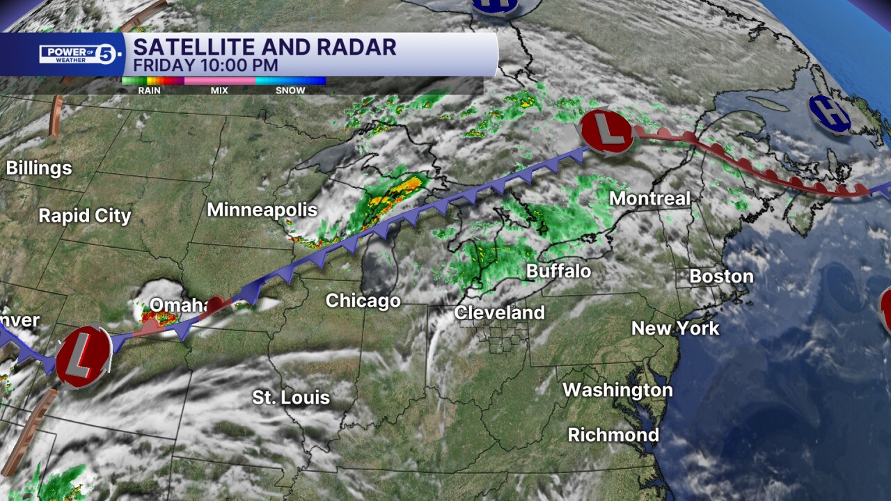
It has been dry across NEO since May 25th! But the dry spell is coming to an end, thanks to a cold front that is to our NW and will slide through Northeast Ohio this weekend. First things first, it will not be a washout this weekend, but it is important to be aware of the storm potential and plan ahead so that you can dash inside to let storms safely pass.
Power of 5's Phil Sakal was live with updates regarding Saturday's storms.
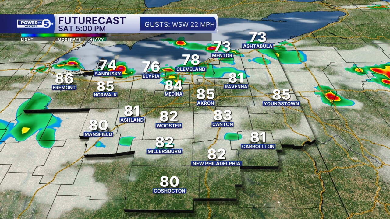
SATURDAY
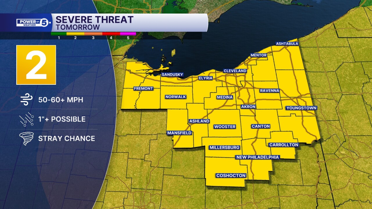
SEVERE POTENTIAL:
The Storm Prediction Center has placed our entire viewing area under a risk for severe storms on Saturday. The yellow color represents a level 2 out of 5 and basically means scattered storms are likely and could become severe, but there will be varying levels of intensity amongst the storms.
Damaging straight-line winds, heavy rain, and frequent lightning will be the main hazards, but the hail and tornado threat is not zero either.
TIMING:
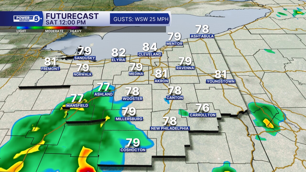
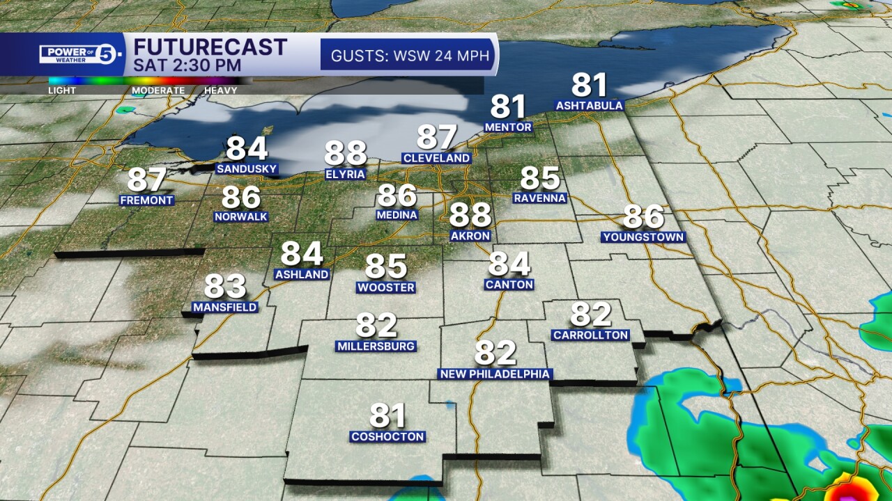
A second round of hit-and-miss storms is developing ahead of the cold front. The second round is the better chance for severe weather from roughly 3 to 10 p.m.
But how these two rounds interact with each other will dictate how strong the second round of storms can become in the second half of the day. If there are only a few showers in the morning, a large gap between the rounds, with more sun, heat, and humidity, there is a greater likelihood of strong or severe thunderstorms.
And while Saturday is active, Sunday is looking much drier, calmer, and slightly cooler, too! Scroll through the images of Futurecast to get an idea about the timing and coverage of storms this weekend. Use these images as a gauge, not gospel truth! Stay weather aware and listen for thunder. When thunder roars, move your party indoors!
Have an audible way to receive watches or warnings, and be sure to keep up with The Power of 5 Weather Team for the latest updates.


Want the latest Power of 5 weather team updates wherever you go? Download the News 5 App free now: Apple|Android
Click here to view our interactive radar.
Follow the News 5 Weather Team:
Trent Magill: Facebook & Twitter
Katie McGraw: Facebook & Twitter
Phil Sakal: Facebook & Twitter
Allan Nosoff: Facebook & Twitter
