


Strong storms along the lakeshore have developed, bringing with them a chance of small hail, high winds and frequent lightning.
News 5 Meteorologist Remeisha Shade has the latest in the player below:
Storm Watches, Warnings and Advisories
A Severe Thunderstorm Watch has been issued for Erie, Huron, Sandusky and Lorain counties, expiring at 1:00 a.m. on June 21.

Remember: Don't drive on flooded roads. Turn around, don't drown.
Areal Flood Advisory issued until 6:45 pm for parts of Cuyahoga and Geaga counties. Power of 5 radar shows around 1-2" of rain has already fallen. Avoid flooded roads! #ohwx#weather #wews #Cleveland pic.twitter.com/gG0eexkNXP
— Remeisha Shade (@RemeishaShadeTV) June 20, 2021
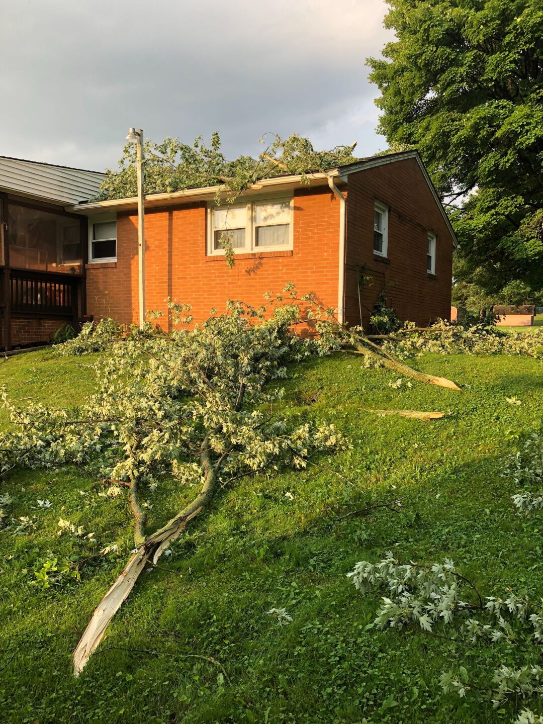
A car got stuck in water that pooled in a Cleveland roadway Sunday afternoon.

It happened in the 4300 block of Lee Road. Police have blocked off the area so other vehicles don't get stuck.
A Beach Hazards Statement has been issued from late Sunday night to Monday night for Lake, Lorain, Erie, Cuyahoga and Ashtabula counties.
Large waves could cause strong currents to develop, making it dangerous for swimmers.
Swimmers are advised not to enter the water. The currents can carry swimmers away from the shore through a sand bar and along structures extending out into the lake.
Power Outages
According to FirstEnergy, hundreds of people across Northeast Ohio are without power.
You can check power outages in your area by clicking here.
Updates from the News 5 Weather Team
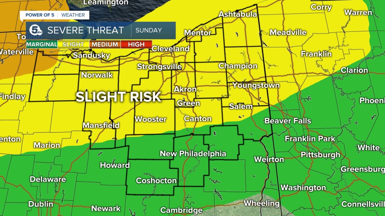
According to Shade, two thirds of Northeast Ohio remain under a slight risk for severe weather. Southern areas are under a low/marginal threat. It's possible that some evening storms could become severe later on.
"Models are hinting at another bigger round of storms late tonight through Monday (morning). As with storms yesterday, main threats are a few damaging wind gusts near 60 mph, hail and heavy rain that could lead to flooding," Shade said.
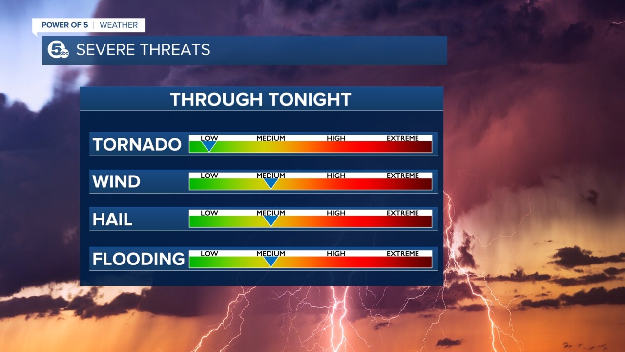
The threat for tornados is low, but Shade said a few of the cells have been rotating so an isolated tornado can't be ruled out.
Another round of storms is possible Monday morning and afternoon, but things look like they will calm down by Tuesday.

Want the latest Power of 5 weather team updates wherever you go? Download the News 5 App free now: Apple|Android
Download the StormShield app for weather alerts on your iOS and Android device: Apple|Android
Click here to view our interactive radar.
Read and watch the latest Power of 5 forecast here.
Follow the News 5 Weather Team:
Mark Johnson: Facebook & Twitter
Remeisha Shade: Facebook & Twitter
