


Happy Weekend!! I hope you had a great Thanksgiving. Rain is returning to the area this weekend as high-pressure shifts east by tonight. This will open the door for an area of low pressure that will lift northeastward tonight. A cold front will also slide through the area Sunday night and into Monday. This system will bring widespread rain and gusty winds for Sunday. Let's break down what to expect each day below!

SATURDAY: It was a frigid start to the day under a mostly clear sky, however, temperatures are swiftly climbing due to southerly winds and ample sunshine. Highs will end up in the mid to upper 50s with a slight breeze out of the southwest at 5-15 mph. For late November, the average high temperature is around 47 degrees - so today will be running about 10 degrees above average! It will be a great day to get outside or to deck the halls!

SATURDAY NIGHT: It will remain dry with increasing clouds this evening and overnight. The clouds will act like a blanket for us, so it will be very mild overnight & early on Sunday. Plan for temps to hang out in the 40s. Rain will also be increasing overnight. Showers will start in the south and spread northward by dawn.

SUNDAY: Showers will become widespread by sunrise on Sunday. Winds will also increase during Sunday afternoon. South/southwesterly wind gusts around 40 mph are possible Sunday afternoon. The Browns game looks to be soaked and gusty. Bring the poncho!

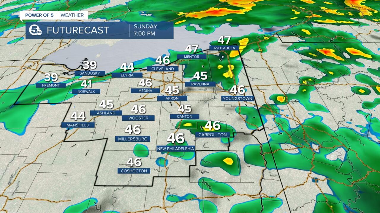
TIMING & TOTALS: Clouds increase this evening. It looks to be mostly cloudy by 9 pm Saturday evening. It will be mild overnight with clouds & rain increasing. The most widespread rain/the heaviest rain looks to occur early on Sunday. While the rain chance is not zero by Sunday evening, sporadic showers will continue through Monday. You may even hear a few rumbles of thunder! Rainfall amounts will be around half an inch to one inch for most locations. A few communities could see locally higher amounts near an inch and a half. Winds will also be increasing late Sunday morning and into the afternoon. Gusts of 30-40 mph will be likely. Highs will be in the low 50s to the upper 40s. Light showers linger into Monday. Scroll through the images of Futurecast to get an idea about coverage and timing below!
-Katie McGraw: Facebook & Twitter


Want the latest Power of 5 weather team updates wherever you go? Download the News 5 App free now: Apple|Android
Download the StormShield app for weather alerts on your iOS and Android device: Apple|Android
Click here to view our interactive radar.
Read and watch the latest Power of 5 forecast here.
Follow the News 5 Weather Team:
Mark Johnson: Facebook & Twitter
Trent Magill: Facebook & Twitter
