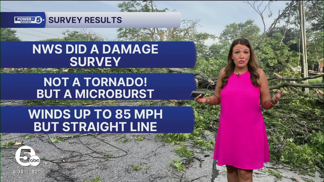


After Wednesday evening's severe weather caused significant storm damage across portions of Lorain County, the National Weather Service went out to survey the damage to determine what had happened.
The meteorologists found damage consistent with two microbursts, not a tornado. A microburst is a localized column of sinking air or a downdraft inside a thunderstorm. It is less than 2.5 miles in diameter. Anything larger than 2.5 miles is a macroburst.
The first microburst affected portions of central Amherst around 8:23 p.m. near Cleveland Avenue and areas just west of South Leavitt Road. Damage included siding torn from a building along Cleveland Avenue, two large trees uprooted along Cleveland Avenue, and several large tree limbs downed onto a detached garage west of South Leavitt Road. In addition, more than 30 large tree limbs were snapped or broken throughout the damaged path. The damage pattern was consistent with divergent winds associated with a microburst.
The second microburst produced significant straight-line wind damage across northeast Amherst with max winds of 85 mph. The area hit the hardest was just north of State Route 2 and near North Ridge Road, including the Cooper Foster Park Road West corridor. News 5 anchor Tessa Ditirro was there Thursday morning and snapped these pictures of the damage. She also spoke with a couple who saw significant damage around their property after the storms.

The NWS also noted that the strong thunderstorm wind gusts overturned a storage container, snapped a utility pole and knocked down a restaurant sign along Cooper Foster Park Road West. Two large trees were uprooted and fell across Cooper Foster Park Road West, and an additional seven trees were uprooted in the surrounding area.
Approximately 50 tree limbs were also downed onto power lines, homes and roadways. As with the first area of damage, the observed pattern was consistent with a microburst producing strong divergent winds.
Based on the extent and severity of the damage observed during the survey, peak wind speeds were estimated at up to 85 mph in the strongest portions of the microbursts.


Want the latest Power of 5 weather team updates wherever you go? Download the News 5 App free now: Apple|Android
Click here to view our interactive radar.
Follow the News 5 Weather Team:
Trent Magill: Facebook & Twitter
Katie McGraw: Facebook & Twitter
Phil Sakal: Facebook & Twitter
Allan Nosoff: Facebook & Twitter
