

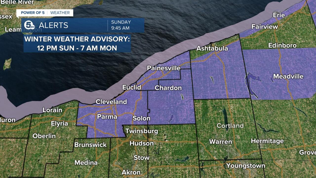
A winter weather advisory has been issued for Lake, Geauga, Cuyahoga, and Ashtabula Inland counties. The advisory goes into effect at 12 p.m. Sunday and continues until 7 a.m. Monday. Expect additional scattered snow showers Sunday afternoon and evening. Plan on slippery road conditions. The hazardous conditions could impact the holiday travel as well as the morning commute on Monday. Take extra caution and slow down.
One to three inches of snow fell Saturday evening and another round of snow is expected on Sunday. An area of low pressure will slide through the region and bring another round of scattered snow showers and lake effect snow.
Convective snow showers/squalls are possible Sunday afternoon and evening. This could result in periods of heavy snow and create slick/snow-covered roads. Lake effect snow showers will continue through early Monday before a brief break.


The highest snowfall totals are expected in areas south of Interstate 90 in Lake County and east of Interstate 271 in Cuyahoga County, especially from 2-10 p.m. Expect about 2-4'' and locally up to 5'' in the snow belt. One to three inches are possible in the surrounding areas by Monday morning.

Want the latest Power of 5 weather team updates wherever you go? Download the News 5 App free now: Apple|Android
Download the StormShield app for weather alerts on your iOS and Android device: Apple|Android
Click here to view our interactive radar.
Read and watch the latest Power of 5 forecast here.
Follow the News 5 Weather Team:
Mark Johnson: Facebook & Twitter
Remeisha Shade: Facebook & Twitter
