


The weather is a wild ride over the next couple of days. It will start off quiet this weekend, but end with roller coaster temperatures, wind, rain, and snow! I will break it all down for you below.

Sunday started off on a quiet note. However, the weather will be all over the place in a short window of time from Sunday to Tuesday as a strong system moves toward Northeast Ohio. A warm front will lift through the area on Sunday and help slowly increase temperatures throughout the day. This will be followed by a potent cold front on Monday causing temperatures to fall once again.

Clouds, temperatures, winds, and rain chances will be increasing on Sunday as this system approaches and moves through NE Ohio.
- Clouds have increased overnight. The rest of Sunday will be mostly cloudy, but mainly dry during the daytime hours.
- Temperatures will be increasing throughout the day on Sunday as the warm front lifts through the area. This will gradually happen, and the warmest temperatures look to happen Sunday night into early on Monday.
 WEWS Katie McGraw
- Winds will also be increasing throughout Sunday. Winds will become strong Sunday evening and into Monday. Expect strong west to southwest winds behind a cold front on Monday. Wind gusts of 40-50 mph are possible.

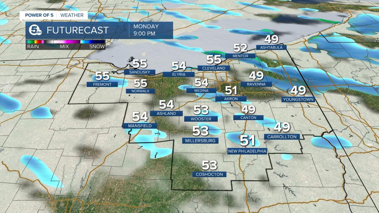
- Rain will be increasing increase as the cold front moves toward NE Ohio late Sunday and into Monday. Stronger storms and the heaviest rain should stay south of our area, but rain looks to become widespread and steady Sunday evening and continue into early Monday. As temperatures fall rain is expected to transition to snow showers by Monday afternoon/evening. At this time, snowfall totals look to be minor.


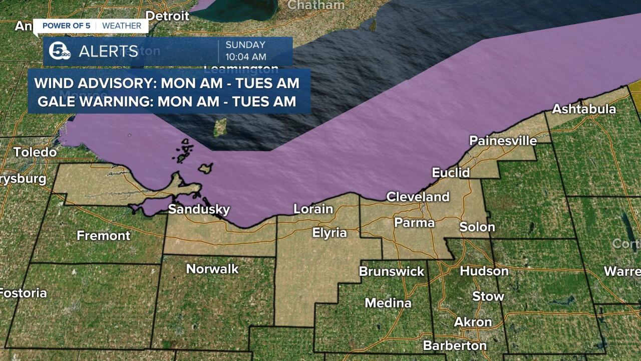
ALERTS
A wind advisory has been issued for Ottawa, Erie, Lorain, Cuyahoga, Lake, and Ashtabula Lakeshore counties. The advisory is in effect starting Monday morning until Monday night. West winds 15 to 25 mph with gusts up to 40-50+ mph expected. Gusty winds could blow around unsecured objects. Tree limbs could be blown down and a few power outages may result. Use extra caution when driving, especially if operating a high-profile vehicle. Secure outdoor objects.
A gale warning has also been issued for Lake Erie from 10 a.m. Monday to 1 a.m. Tuesday. West gales 35 to 40 knots with gusts up to 50 knots and waves 9 to 14 feet expected. Strong winds will cause hazardous waves which could capsize or damage vessels and reduce visibility.
This article will be updated over the next few days. Be sure to check back for any updates and tune into News 5 at 11 and Good Morning Cleveland from 8-10 am.
Want the latest Power of 5 weather team updates wherever you go? Download the News 5 App free now: Apple|Android
Download the StormShield app for weather alerts on your iOS and Android device: Apple|Android
Click here to view our interactive radar.
Read and watch the latest Power of 5 forecast here.
Follow the News 5 Weather Team:
Mark Johnson: Facebook & Twitter
Remeisha Shade: Facebook & Twitter
