


CLEVELAND — June was a dry month and caused portions of Northeast Ohio to fall into the early stages of drought. About half of the viewing area is abnormally dry. As of July 16, Cleveland at Hopkins Airport is about 1.50 inches below average since the beginning of meteorological summer (June 1). Lawns are brown and crunchy and we are in need of some rain....and widespread rain is likely on Saturday.

Timing may not be ideal with so many activities and events during summer weekends...so let's discuss when rain is most likely and how much rain to expect from Sunday and Monday.
SUNDAY:
After a few spotty showers and storms on Saturday, rain will increase in coverage and intensity on Sunday with rounds of rain. A stalled boundary will hang out near Lake Erie and allow an area of low pressure to move along the front and bring widespread rain to Northeast Ohio.

The best chance for rain will be after noon on Sunday until Monday afternoon. Rain will move from the south and west and continue to gradually spread to the north and east throughout the afternoon and into this evening. Rain and storms will pick up in intensity after 3 p.m. with heavy rain and strong storms. There will be dry periods, but rain is likely all day Sunday, Sunday night, and Monday morning. Rain will gradually taper off Monday afternoon and evening. We look dry by Monday night and Tuesday.
Scroll through the images of Futurecast to get an idea regarding timing and coverage with storms Sunday and Monday.


TOTALS & SEVERE POTENTIAL:
The biggest issue for the majority of NE Ohio will be widespread heavy rain. While we are in need of rain, we do not want too much rain too fast. The Power of 5 Weather Team will be monitoring for any flooding concerns over the next two days.
As of Sunday morning, 1-2 inches of rain will be possible across many communities in Northeast Ohio by Monday night. Locally higher amounts (2.00 - 3.00''+) will be possible that could lead to flooding. Use the graphic below as a gauge for rainfall amounts through early Monday.

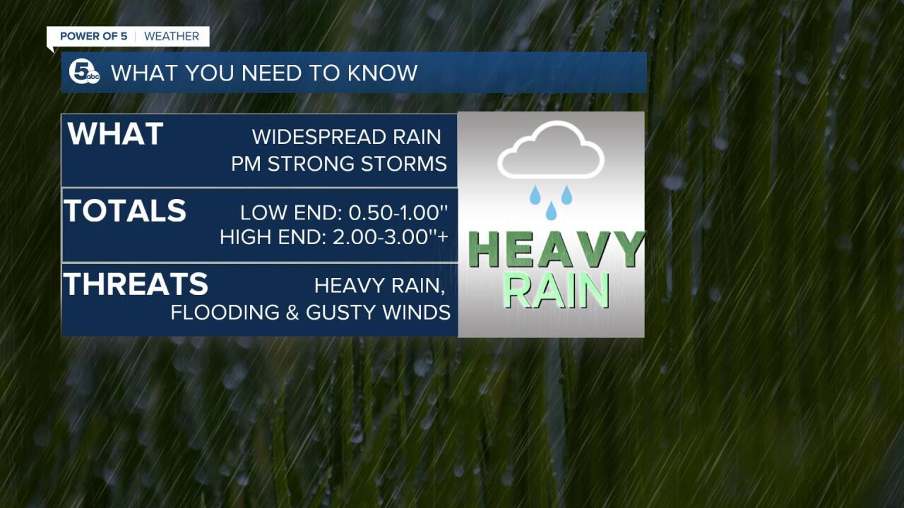
Widespread severe weather is not likely, but there could be a few strong or severe storms in our southeastern communities this afternoon and evening. Besides heavy rain there, damaging gusty winds will also be possible with frequent lightning.
I will continue to update this article all weekend long. Be sure to come back and check for the latest updates! Have a great weekend.
-Katie McGraw: Facebook & Twitter

Want the latest Power of 5 weather team updates wherever you go? Download the News 5 App free now: Apple|Android
Download the StormShield app for weather alerts on your iOS and Android device: Apple|Android
Click here to view our interactive radar.
Read and watch the latest Power of 5 forecast here.
Follow the rest of the News 5 Weather Team:
Mark Johnson: Facebook & Twitter
