


A Winter Weather Advisory is in effect for multiple Northeast Ohio counties this evening and lasts through Monday night, according to the National Weather Service.
The following counties will be under this watch from 7 p.m. on Sunday to 1 a.m. on Tuesday:
- Lake
- Cuyahoga
- Medina
- Geauga
- Ashtabula
- Summit
- Lorain
The following counties are under the same advisory from 6 p.m. on Sunday to 7 p.m. on Monday:
- Erie
- Huron
Additionally, Huron County has issued a Level 1 Snow Emergency for Sunday.
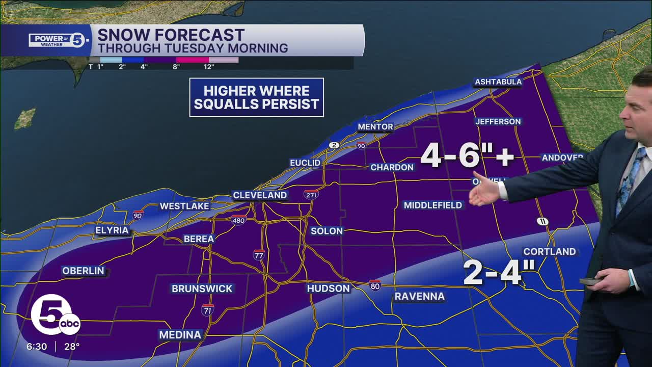
While snow will begin to fall earlier on Sunday from a clipper, lake-effect snow will develop Sunday evening through Monday, with six inches or more possible in the primary snowbelt through Monday night.
When all is set and done between Sunday's clipper and Monday's lake effect snow, 4 to 6 inches is likely in the purple-shaded area, from Eastern Lorain through to Ashtabula counties. Isolated 7 or 8-inch amounts are possible where squalls persist, most likely in Geauga County.
For areas outside the alert, from Akron points south, 2-4" total is expected Sunday through Tuesday, and that encompasses most of the viewing area.

Want the latest Power of 5 weather team updates wherever you go? Download the News 5 App free now: Apple|Android
Click here to view our interactive radar.
Follow the News 5 Weather Team:
Trent Magill: Facebook & Twitter
Katie McGraw: Facebook & Twitter
Phil Sakal: Facebook & Twitter
Allan Nosoff: Facebook & Twitter
