


Power of 5 Winter Forecast: A Planet-Driven Season With a Fast Start
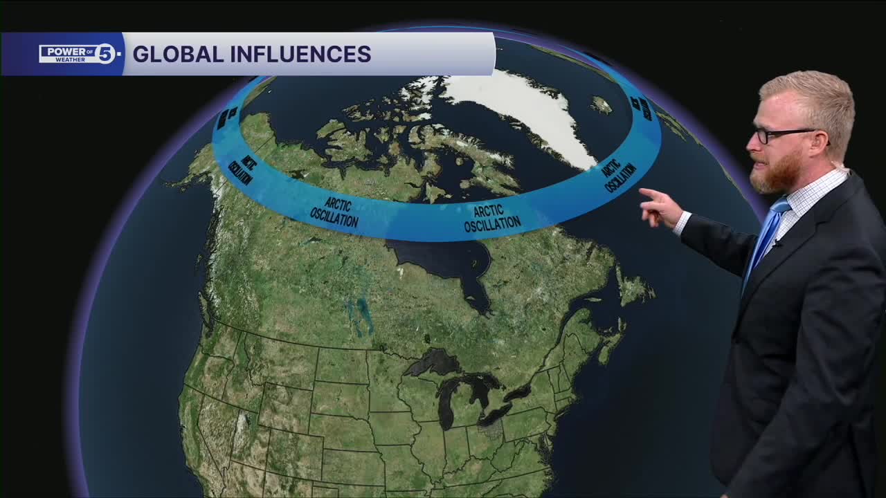
Contrary to years in the past... this winter isn’t being steered by just one dominant pattern. In fact, the entire planet has more influence this year than in most recent winters — and that opens the door to a much wider range of outcomes.
A Winter Without a Clear El Niño or La Niña Driver
We talk about El Niño and La Niña a lot because they often set the tone for the entire season. But this year, neither is in control. With no dominant signal in the tropical Pacific, other ocean–atmosphere patterns are stepping into the spotlight.
Oceans Take the Lead
Much of what happens in our winter weather begins with the oceans. One major player this year is the Pacific Decadal Oscillation (PDO) — a long-term, 10-year cycle that is currently leaning colder for the U.S. We can look even closer and see how strong the signal is... When we break that pattern down even further, two additional Pacific-based signals also tilt us toward colder air intrusions. Doubling (or tripling) down on the confidence.
For moisture... we need to look elsewhere. The Atlantic is chiming in for this. The North Atlantic Oscillation (NAO) has been hinting at a wetter-than-normal pattern for the East Coast, which can help steer storm systems closer to Ohio if it trends negative for long stretches.
Early Arctic Blasts and a Busy Stratosphere
We’ve already seen several early-season shots of arctic air, and that’s a sign of what’s possible going forward. Add in a negative Quasi-Biennial Oscillation (QBO) — a stratospheric wind pattern known to support more active winter weather — and the atmosphere is signaling that it’s primed for action.
Combine all of these pieces, and you get a winter setup with higher volatility than usual.

So What Does It Mean for Northeast Ohio?
In short: this winter starts fast.
December is the month to watch. The pattern favors a quick, aggressive start with frequent cold snaps and the potential for lake effect snow storms early on. The bright side to the cold... Ice forms on Lake Erie and shuts the lake effect snow machine down... That should happen sooner than recent years!
The rest of the season becomes more of a wildcard. We still expect cold air overall, but unless the Atlantic cooperates and we tap into repeated nor’easter tracks, snowfall could ease up during the second half of winter. January, in particular, is the big unknown this year — one major storm could completely reshape seasonal totals.
The Official Power of 5 Forecast
After weighing the global patterns and early-season setups, the Power of 5 Winter Snow Forecast for Cleveland comes in at:
➡️ 53 inches of snow
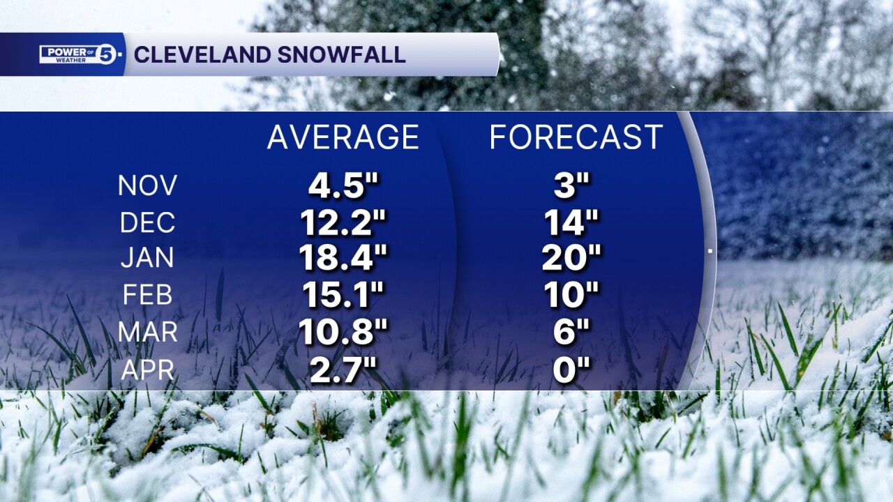
That’s a season that leans below average — but with enough atmospheric players in the mix that one well-timed January system could push us much closer to normal.
Want the latest Power of 5 weather team updates wherever you go? Download the News 5 App free now: Apple|Android
Click here to view our interactive radar.
Follow the News 5 Weather Team:
Trent Magill: Facebook & Twitter
Katie McGraw: Facebook & Twitter
Phil Sakal: Facebook & Twitter
Allan Nosoff: Facebook & Twitter
