


7 AM UPDATE: A Torando Warning has been issued for Ashtabula County until 7:30 a.m.
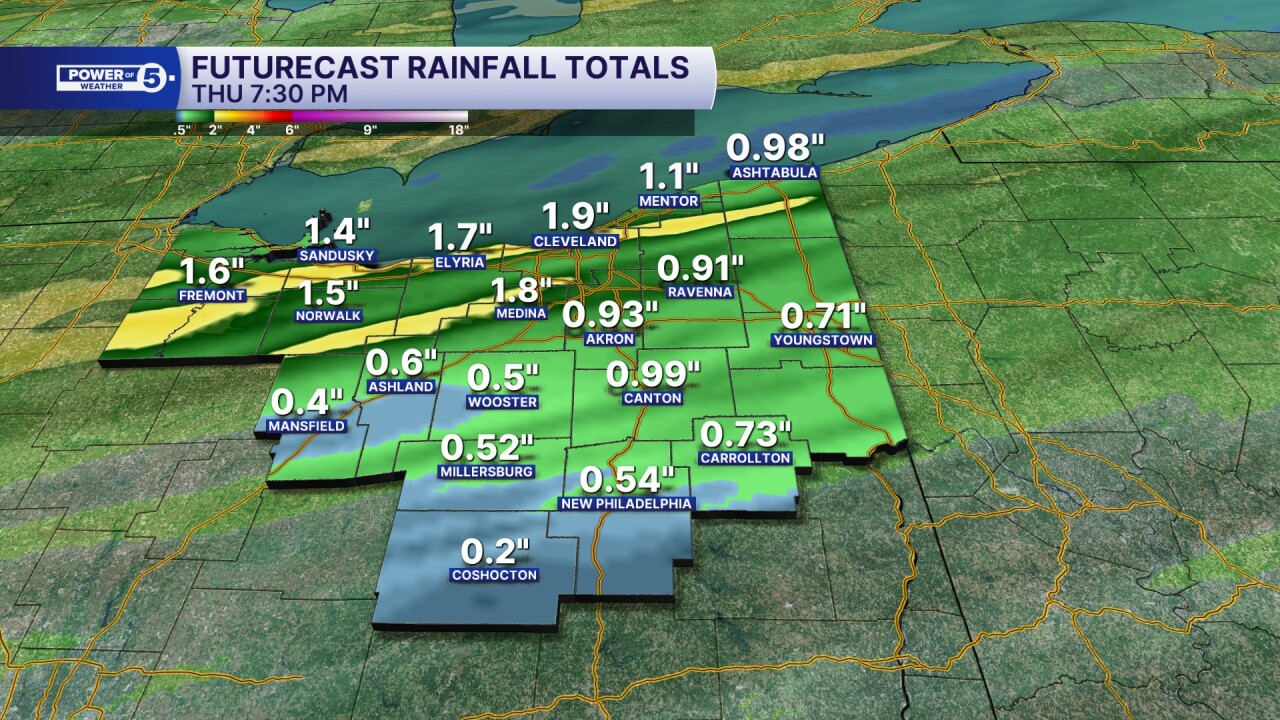
DETAILS ON WET WEATHER: Rain is spreading from west to east this evening. Coverage and intensity of rainfall will pick up after 8 p.m. Plan for rain from 8 p.m. until about sunrise tomorrow. For areas hit with repeated rounds of heavy rain, 1-2 inches will be possible. On the low side, rainfall amounts will be around 0.25 to 1 inch.
Repeated rounds of heavy rain could also lead to flooding overnight. Nighttime flooding is particularly dangerous because it can be hard to see if a road is flooded in the dark. Be sure to check back for the latest alerts. You can also check News 5's app for weather alerts as well. Download the News 5 App free now: Apple|Android
DETAILS ON WINDY WEATHER: Winds will be increasing after 8 p.m. as well. Gusts over 40 mph are likely for much of Northeast Ohio from 8 p.m. to 2 a.m., but a few spots could see wind gusts over 50 mph. This is most likely in the primary snowbelt, or "windbelt" in this case.
Therefore, the National Weather Service has issued a Wind Advisory for the following counties from midnight to Thursday at 6 p.m.:
- Ashtabula
- Cuyahoga
- Geauga
- Lake

SEVERE POTENTIAL: While strong winds are expected regardless, we will also be watching the radar for damaging wind gusts over 60 mph. The greatest threat of seeing severe storms will be along and west of I-77. It is even more likely across southwestern Ohio, near Dayton and Cincinnati. Isolated large hail and quick spin-ups or tornadoes cannot be ruled out. The tornado risk will also be the highest in western Ohio, especially west of I-71. We are lacking instability tonight, so lightning will likely not be as frequent as usual.

Timing: Rain is increasing as I type (Katie McGraw around 7:30 p.m. on Wednesday) and will persist through the wee hours of Thursday morning. The timeline for the greatest risk is expected to move in after sunset through 2 a.m., as a cold front begins to move in and through from the northwest. Heavy rain will gradually shut down from the NW to SE between 2 and 7 a.m. on Thursday. The rest of Thursday will be drier by the afternoon, but a few spotty showers will still be possible. Winds will gradually decrease, but it will remain breezy through the evening.
Power outages: Communities could face power outages from these storms and strong winds. Gusty winds will blow around unsecured objects. Tree limbs could be blown down as well. Winds this strong can make driving difficult, especially for high-profile vehicles. Use extra caution on the roads, especially with the heavy rain threat as well.
Visit our Power Outage page to find links to see current power outages in Northeast Ohio and to report a power outage.
MARINE ALERTS: It will be dangerous on Lake Erie. There is a high risk for rip currents due to the increased wind and wave action. Winds of 25-30 kts are expected with waves of 3-6 feet, but at times could increase to 7 to 10 feet. Small craft advisory (skinny purple line along the western waterfront), Gale warning (bigger purple box to the east side of the lake), and Beach Hazard Statement (blue boxes) have all been issued for tonight and tomorrow.

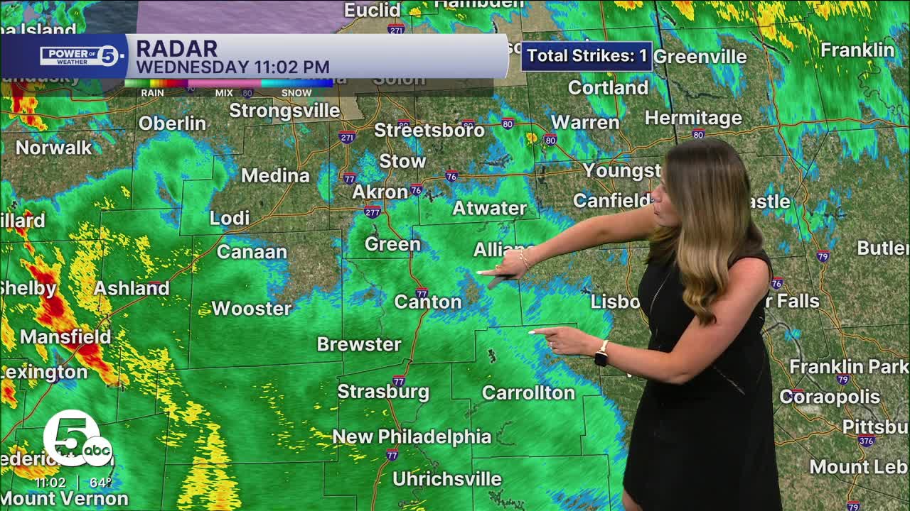
Radar
Click here to view our interactive radar.
Send us your photos
Please stay safe! Do not put yourself in danger to get a photo or video of severe weather. You can send us photos and short videos by CLICKING HERE.
Want the latest Power of 5 weather team updates wherever you go? Download the News 5 App free now: Apple|Android
Click here to view our interactive radar.
Follow the News 5 Weather Team:
Trent Magill: Facebook & Twitter
Katie McGraw: Facebook & Twitter
Phil Sakal: Facebook & Twitter
Allan Nosoff: Facebook & Twitter
