


CLEVELAND — Storms are moving back into NE Ohio - just in time for the weekend. There is some good news and bad news with this system though. Let’s dissect below!
SET UP
There is a ridge of high pressure to our east and a front that will stall to our west. This stalled front will be the catalyst for storms and heavy rain this weekend. At this time, the axis of heaviest rainfall will steer clear from the News 5 viewing area. However, the rain and storm chance is not zero either!

THE BAD NEWS
Some of these storms could become strong or severe. The Storm Prediction Center has upgraded the severe weather risk for our NW communities for this afternoon and evening. That is a level 2/5. Main threats will be heavy rain, gusty winds, frequent lightning and an isolated tornado. The best chance for strong storms is in our NW Communities and this area is also the best chance for heavy rain that could lead to flooding. The threat for severe storms is conditional based on clearing skies and increasing instability between areas of storms.

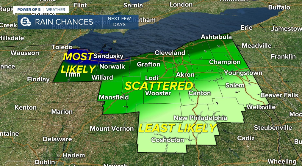
THE GOOD NEWS
Not everyone will see storms and there will be plenty of dry time this weekend. I want to stress the fact that not everyone will be treated the same by this system. News 5 covers several counties and the conditions will be different across that area. The best chance throughout the next few days will be to the NW.
TIMING
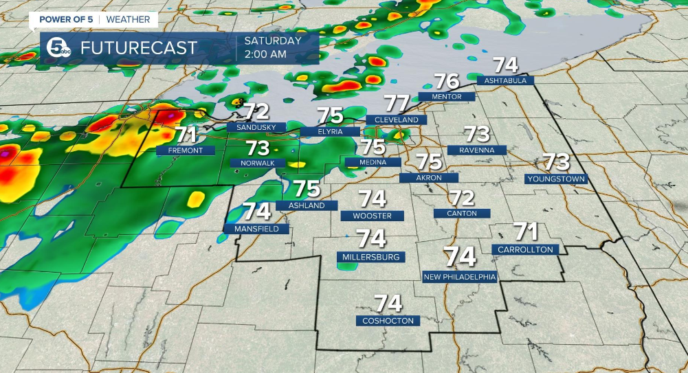
The best chance to see showers and storms in more locations is today, tonight and early on Saturday. A line of heavy rain and isolated storms is moving across the News 5 viewing area right now. Another disturbance over IL/IN is going to bring additional storms late this afternoon and early evening. The second round is the best shot for strong to severe storms. However, remember that is a conditional threat for severe weather.


As we move into the rest of the weekend, the rain chance comes down for much of the area. With drier weather, temperatures will climb into the upper 80s and low 90s. It will feel even hotter with high dew points in the upper 60s and low 70s. This will make it feel very muggy outside.

