


CLEVELAND — Another warm and muggy overnight, with lows in the low to mid 70s across NEO. Skies will remain mostly clear tonight through early Tuesday morning.
We'll notice more clouds on Tuesday, along with more heat and humidity. Highs once again will top off in the low to mid 90s, with heat index values topping off in the low 100s for the 3rd straight day in NEO. An isolated storm chance will be with us by Tuesday afternoon. Heavy rain, frequent lightning and some gusty winds will be possible from any storms that pop up.
More shower and storm chances move in for the overnight Tuesday through the end of the week. With the clouds and rain chances, temperatures will not be as hot, but the humidity will linger for the rest of the week. Heavy rain, frequent lightning and some gusty winds will be possible from any storms for the rest of the week.
Stay cool!
DAILY FORECAST:
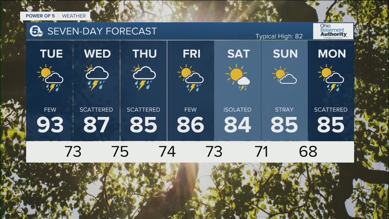
Monday Night: Warm & muggy. | Low: 73º
Tuesday: Hot again with a few afternoon storms. | High: 93º
Wednesday: Scattered t-storms. Muggy. | High: 87º
Thursday: Scattered t-storms. Muggy. | High: 85º
Friday: A few t-storms. | High: 86º
Download the News 5 app for the latest weather updates:
Follow the News 5 Weather Team:
Trent Magill: Facebook & Twitter
Katie McGraw: Facebook & Twitter
Phil Sakal: Facebook & Twitter
