



CLEVELAND —
Brief break before wet weekend
We'll keep a few showers/downpours in the forecast through tonight, but they will be very isolated. It will remain stuffy tonight, but humidity drops noticeably, making it feel much more comfortable as winds pick up as we move into Friday.
Expect a few final sprinkles Friday morning, but it will be a much drier, brighter, cooler, and breezier day. There is a moderate risk for rip currents in Lake Erie with Northeast winds around 10-20 mph, so use extra caution in and around the water.
Friday is the pick of the week. Humidity and rain chances ramp back up by Saturday and linger into Sunday. Saturday's rain chance will increase throughout the day. Heavy rain will be possible on Sunday, bringing a renewed threat for flooding across NEO.
The Power of 5 Weather team will continue to monitor the flood threat. Keep in mind that rain could impact any outdoor plans you have this weekend. It will get cooler by next week with lingering rain chances.
Power of 5 Regions Highlight: West Region
The West Region was today's area of concern, but it also looks like it will be the region that could receive the heaviest rainfall on Saturday.
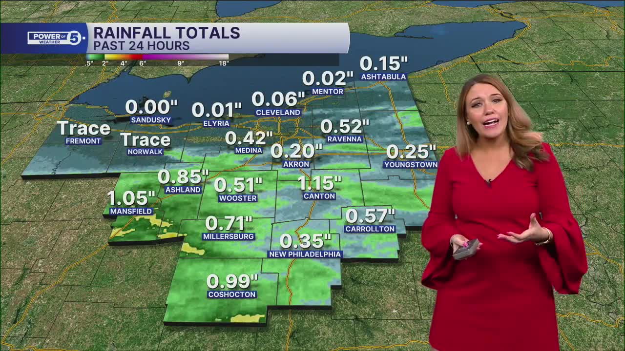
Repeated rounds of rain have already saturated the ground after 1-3 inches of rain fell in the area over the last 24 hours. The break on Friday will help, but with additional heavy rain in the forecast for the weekend, localized flooding will continue to be a concern starting on Saturday.
5-Day Forecast
Thursday: Scattered Storms. Humid.| High: 75º
Friday: Isolated showers lingering. A bit cooler. | High: 72º
Saturday: Scattered t-storms. | High: 75º
Sunday: Scattered t-storms. | High: 72º
Monday: A few showers. Cooler! | High: 69º
Learn the lingo: The Power of 5 Weather Team wants to get you your forecast closer to home. We have broken NEO into 5 separate and distinct regions. Find your region to get your hyper-local forecast!
- Cleveland Metro Region: Cuyahoga County. This region includes cities such as Cleveland, Parma, Westlake, Berea, Strongsville, Independence, Solon, Beachwood, and Euclid.
- Snowbelt Region: Lake, Geauga, and Ashtabula Counties. This includes cities such as Mentor, Geneva, Ashtabula, Bainbridge, Chardon, Burton, and Orwell.
- Akron-Canton Region: Summit, Stark, and Portage Counties. This region includes cities such as Akron, Canton, Hudson, Ravenna, Mantua, Alliance, and Canal Fulton.
- West Region: Lorain, Medina, Erie, Huron, Richland, and Ashland Counties. This region includes cities such as Lorain, Wellington, Medina, Lodi, Ashland, Mansfield, Willard, and Sandusky.
- South Region: Wayne, Holmes, Tuscarawas, Carroll Counties. This region includes Wooster, Millersburg, New Philadelphia, Strasburg, Mineral City, Carrollton, and Newcomerstown
You can send us photos and short videos by filling out the form below:
Want the latest Power of 5 weather team updates wherever you go? Download the News 5 App free now: Apple|Android
Click here to view our interactive radar.
Follow the News 5 Weather Team:
Trent Magill: Facebook & Twitter
Katie McGraw: Facebook & Twitter
Phil Sakal: Facebook & Twitter
Allan Nosoff: Facebook & Twitter
