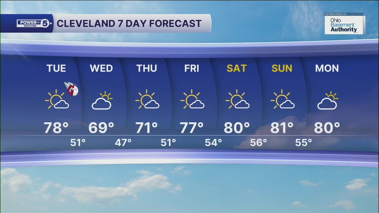


CLEVELAND — We're going to see another well-above-average day to round out the month of September. Tuesday will be a bit of a transition day, as there will be more clouds and highs just shy of 80. The clouds are associated with a cold front, but they will not bring any rain on Tuesday night.
More clouds and cooler temperatures are expected behind the cold front on Wednesday, with highs near 70 degrees, which is near average for this time of year. It is short-lived as warmer weather moves in again, with highs approaching 80 degrees again by this coming weekend.
Rain chances appear to be on hold for the next week, so you'll need to keep the plants watered once again. The current streak of dry days is 4 days, and that will likely grow to 9 or 10 at minimum.
DAILY FORECAST:
Tuesday: Still dry, slightly cooler. | High: 78º
Wednesday: More clouds. Cooler! | High: 70º
Thursday: More sunshine. Seasonable. | High: 72º
Friday: Warmer again. Mostly sunny. | High: 77º
Saturday: Even warmer! More sunshine. | High: 80º
Want the latest Power of 5 weather team updates wherever you go? Download the News 5 App free now: Apple|Android
Click here to view our interactive radar.
Follow the News 5 Weather Team:
Trent Magill: Facebook & Twitter
Katie McGraw: Facebook & Twitter
Phil Sakal: Facebook & Twitter
Allan Nosoff: Facebook & Twitter
