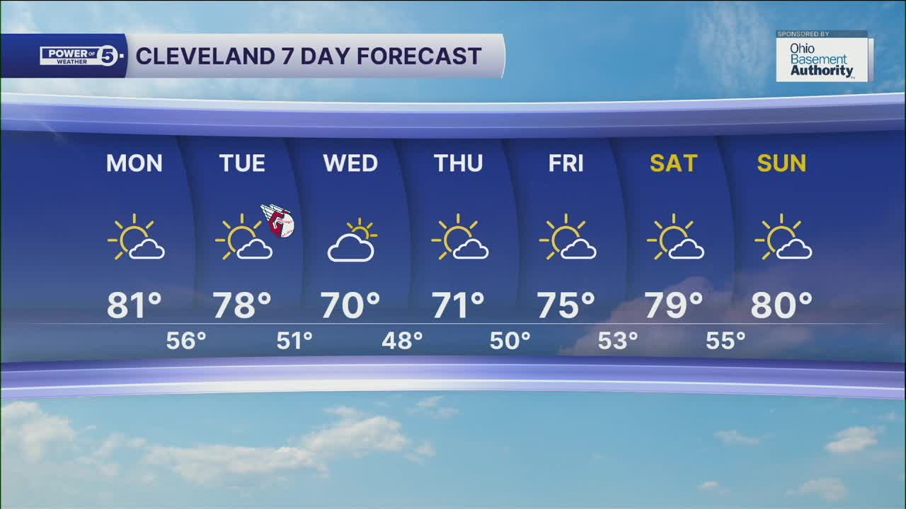


CLEVELAND — Well, the calendar may say it is Fall across NEO, but Momma Nature has not gotten the memo! Temperatures will continue to be 10 to 15+ degrees above average as we wrap up September. Highs will top off in the low to mid 80s to start off the new work week.
Temperatures will begin to drop for the middle of the week, as highs return to more seasonable levels by Wednesday and Thursday. Highs will be only around 70, with lows in the 40s.
It will be a short-lived cool down, as highs will climb back into the mid to upper 70s by Friday and next weekend.
Skies will remain mostly sunny for the majority of the next several days with high pressure in control for most of the week.
Rain chances appear to be slim to nil for the next week and more across the area, so you'll need to keep the plants watered once again!
DAILY FORECAST:
Monday: Similar story. Mostly sunny. | High: 81º
Tuesday: Still dry, slightly cooler. | High: 77º
Wednesday: More clouds. Cooler! | High: 70º
Thursday: More sunshine. Seasonable. | High: 72º
Friday: Warmer again. Mostly sunny. | High: 75º
Saturday: Even warmer! More sunshine. | High: 79º
Want the latest Power of 5 weather team updates wherever you go? Download the News 5 App free now: Apple|Android
Click here to view our interactive radar.
Follow the News 5 Weather Team:
Trent Magill: Facebook & Twitter
Katie McGraw: Facebook & Twitter
Phil Sakal: Facebook & Twitter
Allan Nosoff: Facebook & Twitter
