


CLEVELAND — Isolated rain and thunder chances will be with us this evening. Otherwise, look for warm and muggy conditions across NEO. Temperatures will be sliding back through the 70s during the second half of the evening.
More showers and a few storms will move in after midnight and will linger into the morning on Sunday. Most of the region begins to dry out for the afternoon on Sunday, but still cannot rule out isolated t'shower chances throughout the afternoon. Highs will be back into the mid 80s, with still humid conditions.
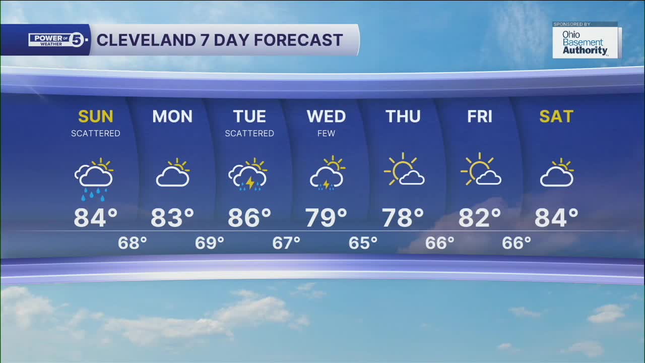
Mostly dry conditions on Monday, give way to more scattered showers and storms on Tuesday, as another cold front moves through the region. A few showers and rumbles of thunder will linger into the morning on Wednesday; otherwise, we will see more drier weather to round out the week. Along with drier conditions, we will see much less humidity and cooler temperatures! Highs will go from the mid to upper 80s on Tuesday, to the upper 70s on Wednesday and Thursday!
DAILY FORECAST:
Sunday: Humid with Scattered t'showers. | High: 84º
Monday: Mostly dry. Humid. | High: 83º
Tuesday: Scattered showers, Few storms. Humid. | High: 86º
Wednesday: Few t'showers. Cooler and less humid. | High: 79º
Thursday: Mostly sunny and pleasant. | High: 78º
Friday: Mostly sunny and warmer. | High: 82º
Saturday: Mostly dry. Touch warmer. | High: 84º
Want the latest Power of 5 weather team updates wherever you go? Download the News 5 App free now: Apple|Android
Click here to view our interactive radar.
Follow the News 5 Weather Team:
Trent Magill: Facebook & Twitter
Katie McGraw: Facebook & Twitter
Phil Sakal: Facebook & Twitter
Allan Nosoff: Facebook & Twitter
