


CLEVELAND — Heat and humidity are building to round out the work week. It will continue to be quiet with dry conditions tonight and for most of Thursday.
Just as the afternoons are getting warmer, so are the nights. Plan for 60s and low 70s tonight and early on Thursday. Not only does the heat jump another 5 to 10 degrees tomorrow, but the dew point/humidity will surge, making it feel EVEN hotter.
Heat indices will be in the upper 90s to the low triple digits Thursday afternoon. A heat advisory has been issued for the majority of NEO. For more information and signs of heat-related illnesses to look for, click here.
Storm chances will begin to return late Thursday and will continue into Friday. Storms look to be scattered or hit or miss through the weekend. We will be watching the radar carefully for any strong or severe storms on Friday and Saturday, including strong wind gusts, heavy rain, and frequent lightning.
It will still be very warm and humid during this time as well, but does not look *as* hot due to scattered storm potential.
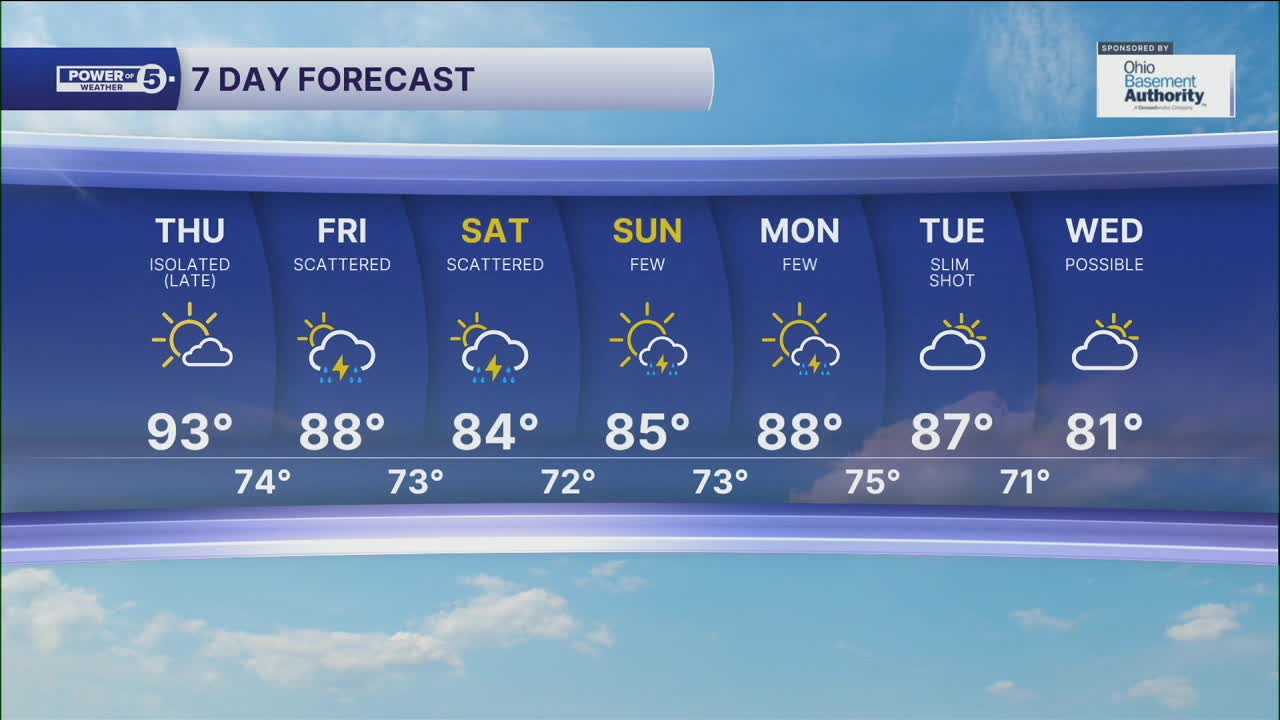
DAILY FORECAST:
Wednesday Night: Milder temps. Stays dry. | Low: 72º
Thursday: Hot again. Dry until late.| High: 94º
Friday: Hot with scattered storms. | High: 88º
Saturday: Humid with more storms. | High: 84º
Sunday: Few storms. Warm & muggy. | High: 85º
Download the News 5 app for the latest weather updates:
Follow the News 5 Weather Team:
Trent Magill: Facebook & Twitter
Katie McGraw: Facebook & Twitter
Phil Sakal: Facebook & Twitter
