


CLEVELAND — After a relatively active week weather-wise, with much-needed rain across NEO, the pattern has flipped back to dry and warm. While there was a slight improvement in the drought situation, it will likely get worse before it gets better across the region.
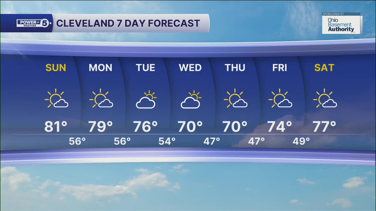
Another dry weather pattern is taking shape for the start of the new week. Temperatures will be well above average on Sunday and Monday, as highs will be around 80! That is 10 degrees above average for the end of September.
Cooler, but closer to par temperatures return to the region for the middle of the week. Highs on Wednesday and Thursday will be around 70. Highs will once again bump up for Friday into next weekend, with temperatures back into the mid to upper 70s!
Rain chances appear to be slim to nil for the next week plus across the area, so you'll need to keep the plants watered once again!
DAILY FORECAST:
Sunday: Even warmer! | High: 81º
Monday: PM clouds. Still warm for September. | High: 79º
Tuesday: Still dry, slightly cooler. | High: 76º
Wednesday: More clouds. Cooler! | High: 70º
Thursday: More sunshine. Seasonable. | High: 70º
Friday: Warmer again. Mostly sunny. | High: 74º
Saturday: Even warmer! More sunshine. | High: 77º
Want the latest Power of 5 weather team updates wherever you go? Download the News 5 App free now: Apple|Android
Click here to view our interactive radar.
Follow the News 5 Weather Team:
Trent Magill: Facebook & Twitter
Katie McGraw: Facebook & Twitter
Phil Sakal: Facebook & Twitter
Allan Nosoff: Facebook & Twitter
