


CLEVELAND — Summer-like weather surges back Monday and Tuesday, along with another chance for stronger storms. Current timing brings storms through on Monday night, limiting the severe potential, with a cold front sparking more storms later on Tuesday, but with limited storm energy left behind. Highs will be well into the 70s on Monday, but will begin to drop for the rest of the week
More rain will return on Wednesday, along a major, prolonged cooldown. The end of the week will see a slight chance for a shower or two, and some mist, with even a snowflake or two possible next weekend. Stay tuned for details on that.
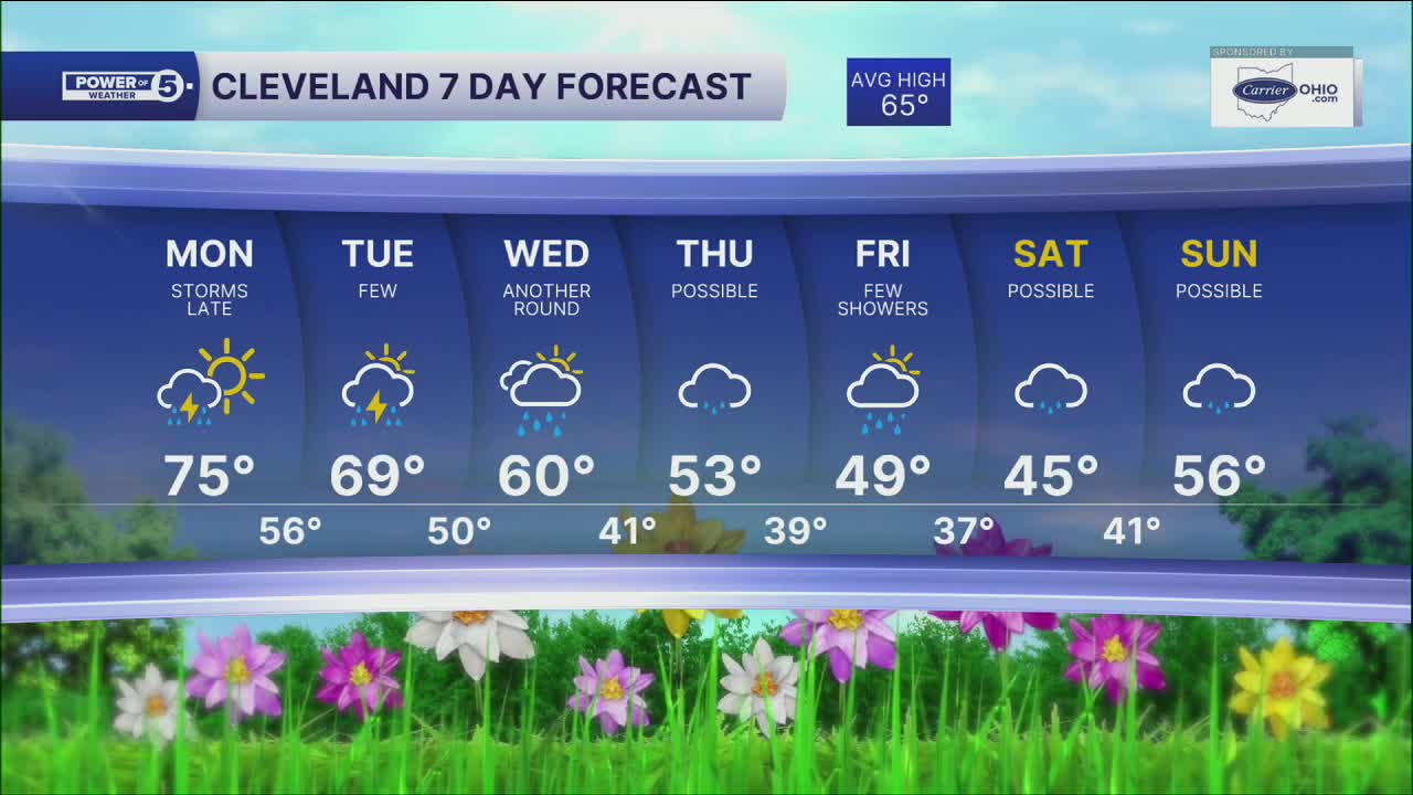
DAILY FORECAST:
Monday: Warming up and breezy! Storms late afternoon into evening. | High: 75º
Tuesday: Few Storms. Breezy & Cooler. | High: 69º
Wednesday: Another round of rain. Colder. | High: 60º
Thursday: Isolated shower. More clouds and cooler. | High: 53º
Friday: Few showers. Chilly. | High: 49º
Saturday: Mostly cloudy. Shower possible. Cool. | High: 45º
Want the latest Power of 5 weather team updates wherever you go? Download the News 5 App free now: Apple|Android
Click here to view our interactive radar.
Follow the News 5 Weather Team:
Trent Magill: Facebook & Twitter
Katie McGraw: Facebook & Twitter
Phil Sakal: Facebook & Twitter
Allan Nosoff: Facebook & Twitter
