

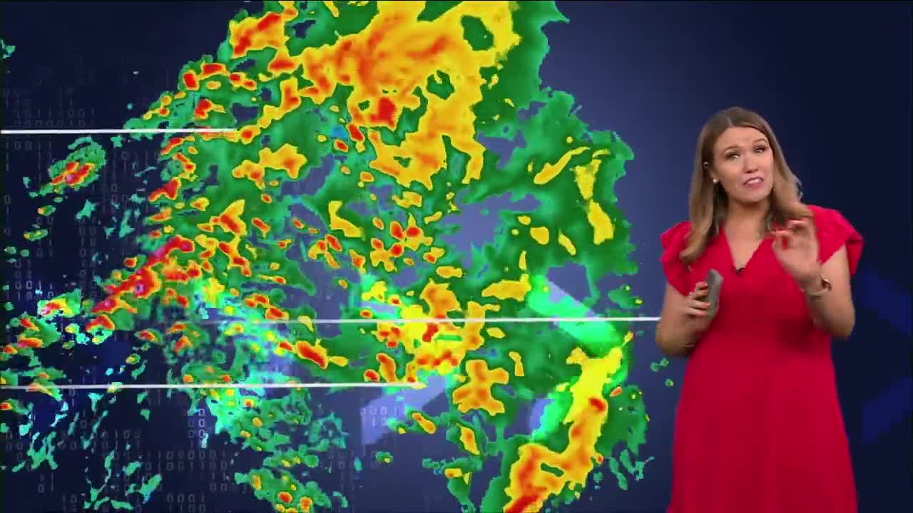


CLEVELAND — Our next chance for storms arrives tonight and continues into Thursday. The exact timing is still a challenge because storms will likely come through in multiple waves, but the overall storm track is shifting directly into Northeast Ohio. Expect multiple rounds of storms on Thursday, with some becoming strong and producing heavy rain, gusty winds, and frequent lightning.
We'll do it all again Friday, especially on Friday morning, although temps will be much cooler as the ridge of high pressure finally slides south. That brings us back closer to seasonal averages heading into the weekend. A few showers may linger into Saturday, but drier weather looks more likely after that.
Power of 5 Regions highlights: Akron-Canton, Snowbelt and CLE Metro Regions:
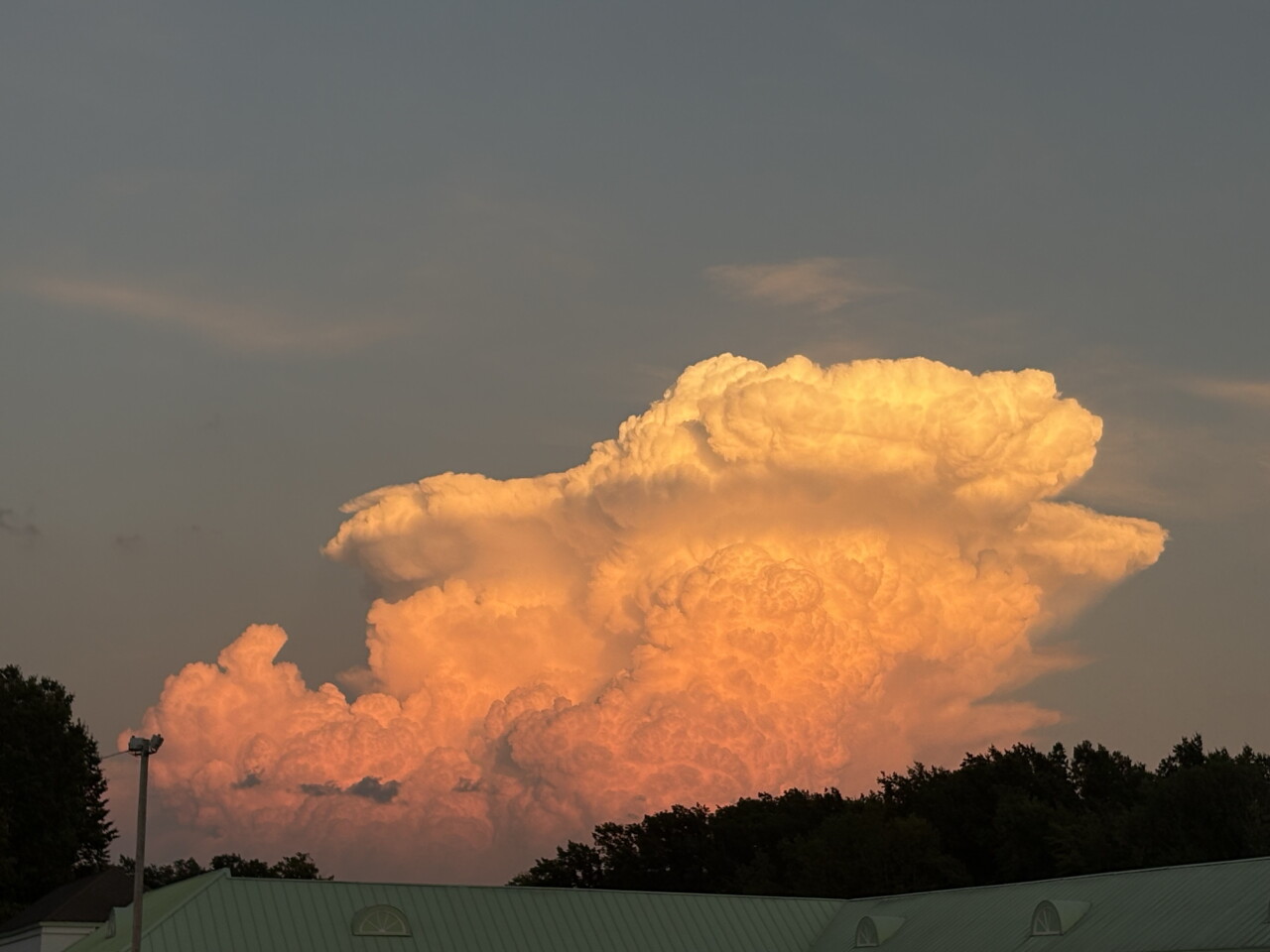
Portage County in the Akron-Canton Region was hit the hardest on Wednesday with repeated rounds of heavy rain and storms, including two severe thunderstorm warnings and one strong storm. The strong storm around 8 pm featured a very photogenic cumulonimbus cloud around sunset. Look at that monster!
Additional storms are expected across the northern half of our viewing area by Thursday morning, especially across the Snowbelt and CLE Metro Regions; but truthfully, everyone has a better chance to see storms tomorrow, and there could be 3 to 4 separate rounds of storms that linger into Friday as well.
Some storms could become strong with damaging wind gusts, heavy rain, and frequent lightning. Keep an eye on the forecast if you have outdoor plans over the next 24 to 48 hours.
Meanwhile, a heat advisory remains in effect for Thursday across our south region on Thursday for heat indices near 100 degrees. Once the cold front moves through, temperatures and humidity will drop by the end of the work week and into the holiday weekend. There will also be a gradual drying trend over the weekend as well.
5-Day Forecast
Wednesday Night: Storms possible. Mild & muggy. | Low: 75º
Thursday: Rounds of t-storms, flooding & damage possible. | High: 88º
Friday: Scattered t-storms, still steamy. | High: 82º
Saturday: A few storms, much cooler | High: 79º
Sunday: Looking dry & Seasonable. | High: 77º
Learn the lingo: The Power of 5 Weather Team wants to get you your forecast closer to home. We have broken NEO into 5 separate and distinct regions. Find your region to get your hyper-local forecast!
- Cleveland Metro Region: Cuyahoga County. This region includes cities such as Cleveland, Parma, Westlake, Berea, Strongsville, Independence, Solon, Beachwood, and Euclid.
- Snowbelt Region: Lake, Geauga, and Ashtabula Counties. This includes cities such as Mentor, Geneva, Ashtabula, Bainbridge, Chardon, Burton, and Orwell.
- Akron-Canton Region: Summit, Stark, and Portage Counties. This region includes cities such as Akron, Canton, Hudson, Ravenna, Mantua, Alliance, and Canal Fulton.
- West Region: Lorain, Medina, Erie, Huron, Richland, and Ashland Counties. This region includes cities such as Lorain, Wellington, Medina, Lodi, Ashland, Mansfield, Willard, and Sandusky.
- South Region: Wayne, Holmes, Tuscarawas, Carroll Counties. This region includes Wooster, Millersburg, New Philadelphia, Strasburg, Mineral City, Carrollton, and Newcomerstown
Want the latest Power of 5 weather team updates wherever you go? Download the News 5 App free now: Apple|Android
Click here to view our interactive radar.
Follow the News 5 Weather Team:
Trent Magill: Facebook & Twitter
Katie McGraw: Facebook & Twitter
Phil Sakal: Facebook & Twitter
Allan Nosoff: Facebook & Twitter
