

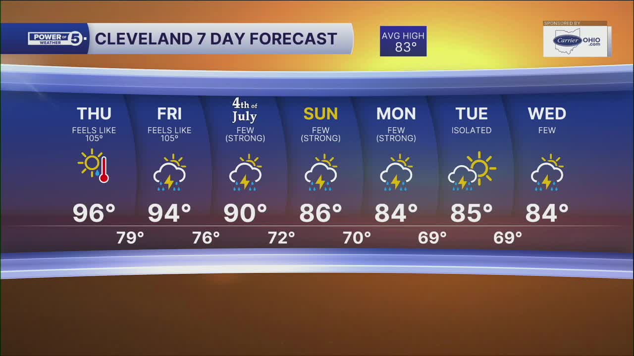


CLEVELAND — Temperatures will not cool down much, as we'll be waking up to mid to upper 70s on Thursday morning
Afternoon temperatures will remain well into the 90s for highs through the end of this week. It's going to remain incredibly humid too. I'm talking southern, Gulf Coast-type humidity. High heat + high humidity = dangerous heat. Heat index values will be 100° to 110° during peak heating (2 to 7 PM) across the region.
Records will be tested on Thursday, as highs will once again be in the mid to upper 90s. We look to remain dry on Thursday.
Better rain chances look to return by the holiday weekend, unfortunately. It is still too soon to talk specifics, but we will keep you posted about impacts to Fourth of July plans!
DAILY FORECAST:
Thursday: Hazy, hot & humid with heat indices in the 100s. |High: 96º, feels like 100-105º
Friday: Still Hot. Isolated storms. |High: 94º, feels like 100º-105º
4th of July: Few storms, still hot & humid. | High: 90º, feels like 95º-100º
Sunday: A few storms. | High: 86º
Monday: A few storms. | High: 84º
Tuesday: Isolated thunder but still more seasonable. | High: 84º
Want the latest Power of 5 weather team updates wherever you go? Download the News 5 App free now: Apple|Android
Click here to view our interactive radar.
Follow the News 5 Weather Team:
Trent Magill: Facebook & Twitter
Katie McGraw: Facebook & Twitter
Phil Sakal: Facebook & Twitter
Allan Nosoff: Facebook & Twitter
