



CLEVELAND — Northeast Ohio is cleaning up after another round of severe weather Thursday that brought damaging winds, flooding, and even high-water rescues in some communities.
One of the most impressive sights was a massive shelf cloud that rolled across the region ahead of the storms. Behind it came damaging wind gusts, torrential rain, and flash flooding.
Unfortunately, we're not done yet.
The same boundary that helped fuel Thursday's storms is still draped across Ohio today. That means we'll be watching for another couple rounds of thunderstorms through the day and evening.
Not every community will see severe weather, but any storm that develops could dump heavy rain in a short amount of time and produce damaging wind gusts.
Make sure you have a way to receive weather alerts and a backup plan ready if warnings are issued. Conditions can change quickly when storms develop.
Power of 5 Regions highlights: Akron-Canton Regions:
The Akron-Canton Region is today's featured Power of 5 Region after being one of the hardest-hit areas during Thursday's storms.
Some communities picked up nearly 5 inches of rain, leading to flooded roads, high water, and standing water that lingered well after the storms moved out.
The ground is saturated, and streams and creeks remain elevated in some locations. That means it won't take much additional rainfall to create new flooding concerns today.
Residents should be especially cautious if more storms develop this afternoon or evening. Even areas that avoid severe winds could experience flooding problems with another round of heavy rain.
The atmosphere won't need much help to produce more strong storms today, so it's a good day to have indoor backup plans ready and keep a close eye on the forecast.
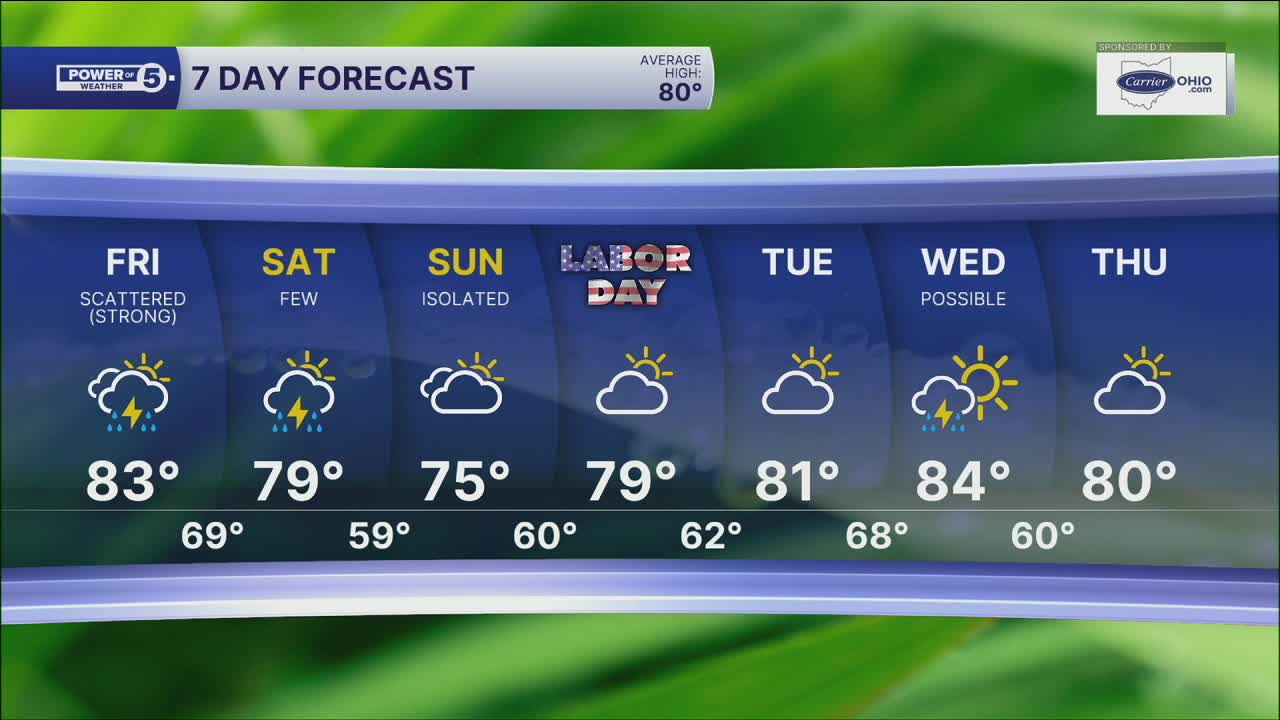
5-Day Forecast
Friday: Scattered t-storms, still steamy. | High: 83º
Saturday: A few storms, much cooler | High: 77º
Sunday: Looking dry & Seasonable. | High: 74º
Labor Day Monday: Dry & mild! | High: 79º
Tuesday: Humidity Building. | High: 80º
Learn the lingo: The Power of 5 Weather Team wants to get you your forecast closer to home. We have broken NEO into 5 separate and distinct regions. Find your region to get your hyper-local forecast!
- Cleveland Metro Region: Cuyahoga County. This region includes cities such as Cleveland, Parma, Westlake, Berea, Strongsville, Independence, Solon, Beachwood, and Euclid.
- Snowbelt Region: Lake, Geauga, and Ashtabula Counties. This includes cities such as Mentor, Geneva, Ashtabula, Bainbridge, Chardon, Burton, and Orwell.
- Akron-Canton Region: Summit, Stark, and Portage Counties. This region includes cities such as Akron, Canton, Hudson, Ravenna, Mantua, Alliance, and Canal Fulton.
- West Region: Lorain, Medina, Erie, Huron, Richland, and Ashland Counties. This region includes cities such as Lorain, Wellington, Medina, Lodi, Ashland, Mansfield, Willard, and Sandusky.
- South Region: Wayne, Holmes, Tuscarawas, Carroll Counties. This region includes Wooster, Millersburg, New Philadelphia, Strasburg, Mineral City, Carrollton, and Newcomerstown
Want the latest Power of 5 weather team updates wherever you go? Download the News 5 App free now: Apple|Android
Click here to view our interactive radar.
Follow the News 5 Weather Team:
Trent Magill: Facebook & Twitter
Katie McGraw: Facebook & Twitter
Phil Sakal: Facebook & Twitter
Allan Nosoff: Facebook & Twitter
