


CLEVELAND — While not a washout, Wednesday was a rainy day. A cooler day, too... highs were near 50 degrees in the morning and fell into the 40s for most of the afternoon and evening.
Any rain showers will taper by midnight or 1 a.m., then some patchy fog and mist is possible lakeside overnight.
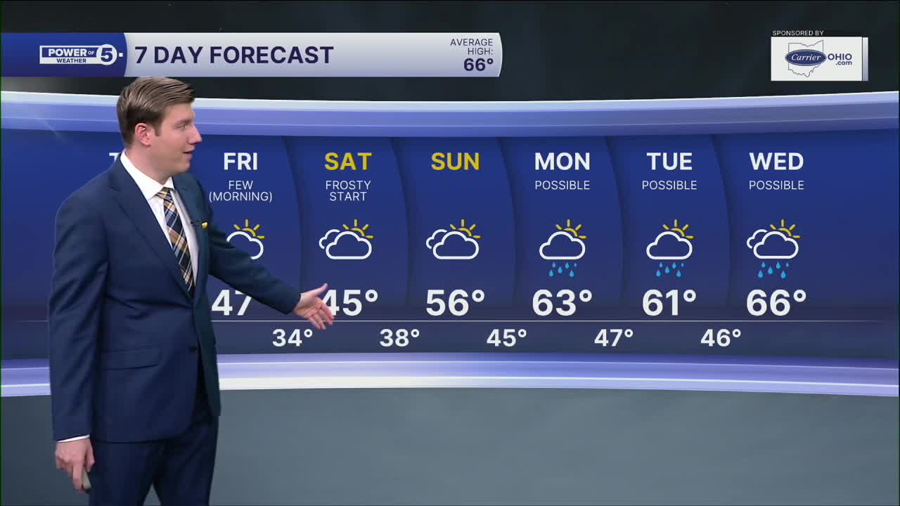
We will remain way below average for this time of year for the rest of the week. That includes frosty mornings for Friday and Saturday. Our average last frost isn't until early/mid-May. So hold off planting that garden until after Mother's Day or so.
A few showers will remain possible on Thursday afternoon and Friday morning. This weekend looks primarily dry, with a slim shot of a shower, but chilly temperatures will linger. Only 40s on Saturday, but a return to the 50s on Sunday.
DAILY FORECAST:
Thursday: A few showers. More clouds and cooler. | High: 48º
Friday: Few showers. Chilly. | High: 47º
Saturday: Mostly cloudy. Showers possible. Cool. | High: 45º
Sunday: Mostly cloudy. Showers possible. Touch warmer. | High: 56º
Monday: Mostly cloudy. Few Showers possible. | High: 61º
Tuesday: Mostly cloudy. Few Showers possible. Cooler. | High: 65º
Want the latest Power of 5 weather team updates wherever you go? Download the News 5 App free now: Apple|Android
Click here to view our interactive radar.
Follow the News 5 Weather Team:
Trent Magill: Facebook & Twitter
Katie McGraw: Facebook & Twitter
Phil Sakal: Facebook & Twitter
Allan Nosoff: Facebook & Twitter
