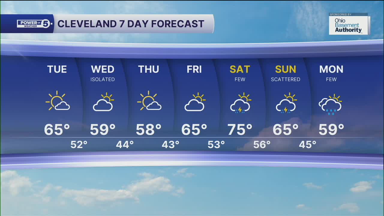


CLEVELAND — Temperatures will be a few degrees above average again for your Tuesday, but we'll notice more clouds across the region as a front begins to move near the region. Highs in Cleveland and points northeast will be once again in the mid to upper 60s; but inland areas will see more upper 60s and lower 70s on Tuesday afternoon.
A shot at isolated showers moves in for the morning on Wednesday, as the front moves through. Behind the front, anticipate temperatures to struggle. Highs will be in the upper 50s to around 60 by Wednesday afternoon through Thursday.
We'll begin to see a jump in temperatures by Friday and the start of the weekend, ahead of our next front. Highs on Saturday will top off in the low to even mid 70s, along with rain chances increasing during the afternoon. Rain chances will linger through Sunday and even into Monday, as temperatures will fall back through the 60s and upper 50s to begin next week.
DAILY FORECAST:
Tuesday: Partly cloudy. Warmer inland.. | High: 65º
Wednesday: Isolated rain showers possible. Cooler | High: 59º
Thursday: Sun returns but temps struggle. | High: 58º
Friday: Partly sunny. Not as cool. | High: 65º
Saturday: T'showers possible. Warmer. | High: 75º
Sunday: Scattered t'showers. Cooler. | High: 65º
Want the latest Power of 5 weather team updates wherever you go? Download the News 5 App free now: Apple|Android
Click here to view our interactive radar.
Follow the News 5 Weather Team:
Trent Magill: Facebook & Twitter
Katie McGraw: Facebook & Twitter
Phil Sakal: Facebook & Twitter
Allan Nosoff: Facebook & Twitter
