


CLEVELAND — The rest of your Monday will be very quiet with a few high clouds and comfortable temperatures. The breezy winds we had earlier in the day will subside tonight, and it will not be as dangerous on Lake Erie with both the risk for rip currents as well as choppy waters decreasing thanks to the lighter winds. Lows will be in the low 60s along the lakeshore to the upper 50s farther inland. It will be variably cloudy overnight and into early Tuesday.
Storms come back tomorrow.
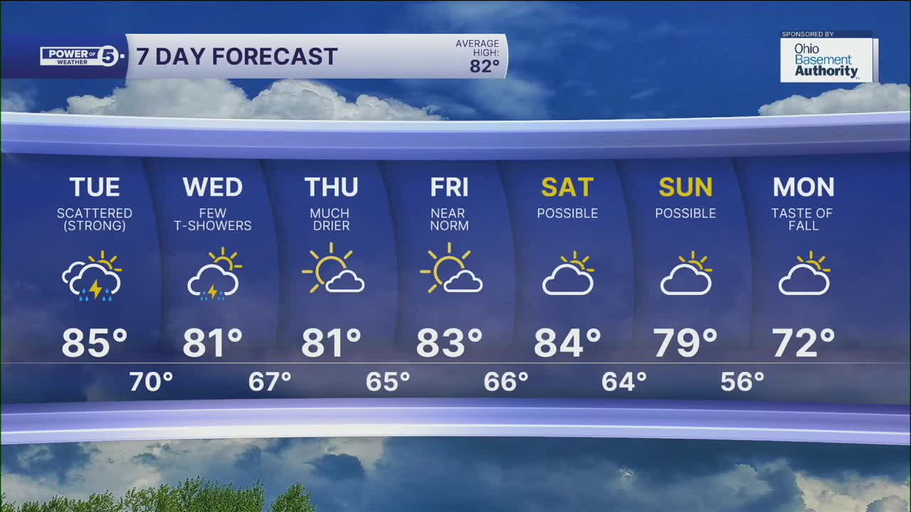
Our next cold front is heading our way on Tuesday. Plan on a stray t-storms in the morning, but the better chance for rain and storms will hold off until the late afternoon and evening. We are expecting a line of rain and thunder sliding east into Ohio from about noon until midnight. The highest coverage of storms will likely be from about 4 pm to 10 pm, with storms gradually fading as we near midnight. The strongest storms will have lightning, heavy rain, and gusty winds. The threat of damage is low but not zero. Make sure you have a way to get updates as these storms roll through NEO.
A few more lingering t-showers are expected on Wednesday, but the coverage and intensity will be lower than Tuesday. The end of the work week looks dry with seasonal temperatures. Another front aims our region this weekend. The exact timing is still in question, but we do know that it will usher in FALL-like temperatures by early next week.
DAILY FORECAST:
Monday Night: Variable clouds, cool temps. | Low: 62º
Tuesday: Scattered storms returning. | High: 84º
Wednesday: Few t-showers, followed by late-day sun. | High: 80º
Thursday: Mostly sunny and pleasant. | High: 81º
Friday: Mostly sunny and warmer. | High: 83º
Saturday: Mostly dry. Touch warmer. | High: 85º
Want the latest Power of 5 weather team updates wherever you go? Download the News 5 App free now: Apple|Android
Click here to view our interactive radar.
Follow the News 5 Weather Team:
Trent Magill: Facebook & Twitter
Katie McGraw: Facebook & Twitter
Phil Sakal: Facebook & Twitter
Allan Nosoff: Facebook & Twitter
