


CLEVELAND — A cold and frosty start to your Monday will give way to more sunshine and a mild afternoon, as temperatures rise to the upper 50s and around 60 to begin the new work week.
Most of the region will remain dry and mild through Wednesday, but the pattern will begin to become unsettled as the week comes to a close.
The next system we are watching is a very complicated setup. The initial storm, which is currently part of an atmospheric river on the west coast, will march over the Rockies and dive into the Deep South midweek. Another coastal storm will be forming at the same time off the Georgia coast. There is a high chance these storms fuse together into one franken-storm on Thursday, and impact our weather on Thursday and Friday, which is Halloween.
The exact track and intensity will be key to how much rain works its way into our area. Showers are possible as early as Wednesday evening as this system approaches, but it is not a guarantee. We will be sure to keep you posted on the latest trends and potential lake-effect precipitation after the storm on Halloween, so be sure to check back or tune in. The lake-effect part of the system could bring significant lake-effect precipitation most of next weekend.
DAILY FORECAST:
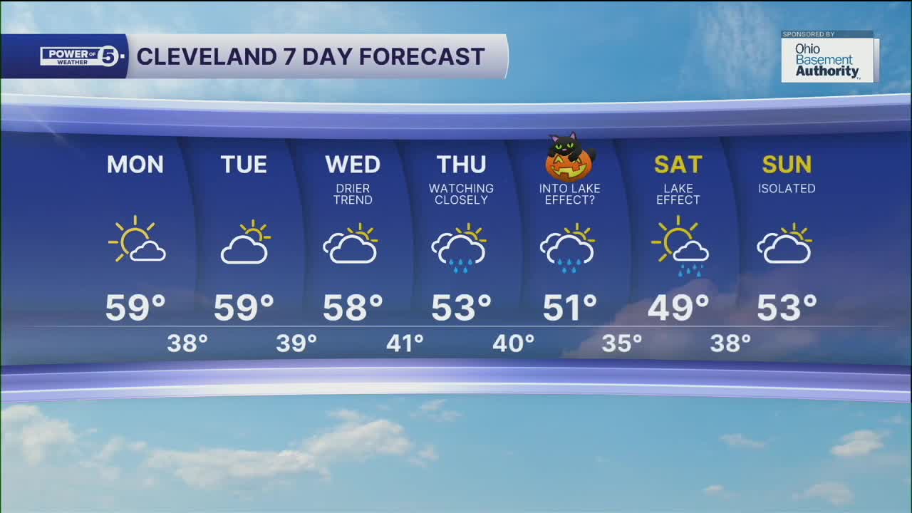
Monday: Frosty AM. Mostly sunny, pick of the week. | High: 60º
Tuesday: More clouds, still dry. | High: 59º
Wednesday: Rain possible late. More clouds. | High: 57º
Thursday: Rain likely. Breezy. Watching closely. | High: 53º
Halloween: Rain tapering to showers, possible lake-enhanced rain. Cool. | High: 51º
Saturday: Lake-effect possible. Chilly. | High: 49º
Want the latest Power of 5 weather team updates wherever you go? Download the News 5 App free now: Apple|Android
Click here to view our interactive radar.
Follow the News 5 Weather Team:
Trent Magill: Facebook & Twitter
Katie McGraw: Facebook & Twitter
Phil Sakal: Facebook & Twitter
Allan Nosoff: Facebook & Twitter
