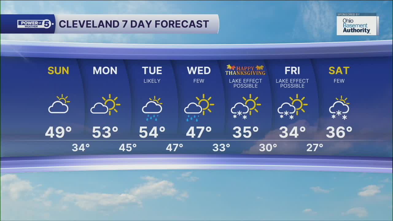


CLEVELAND — Highs will return to the mid-to-upper 40s for many on Sunday. Clouds will begin to thin for the afternoon, especially.
The work week will begin dry, but this will not last long, as Tuesday is expected to see potentially heavy rain. A large storm, spanning over a dozen states, will bring rain on Tuesday, with some lingering showers through Wednesday. The storm will then pull significantly colder air by Thanksgiving and Black Friday.
With colder temperatures and lingering moisture, lake effect snow is also possible on Thanksgiving and Black Friday, possibly even into the following weekend. It is still nearly a week out, and there are many moving parts in the atmosphere, including the critical wind direction that is responsible for producing the lake effect. So, expect updates to the forecast. We will keep you posted all throughout the week. Stay tuned!
DAILY FORECAST:
Sunday: Dry and mild.| High: 49º
Monday: Clouds return, still nice. Rain is possible by Monday night. | High: 53º
Tuesday: Looking wet and mild. | High: 54º
Wednesday: Showers possible. Dropping temperatures. | High: 47º
Thanksgiving Day: Breezy & colder. Lake Effect Snow Possible. | High: 35º
Friday: Lake Effect Snow Possible. Cold & Breezy. | High: 34º
Saturday: Snow showers possible. Cold. | High: 36º
Want the latest Power of 5 weather team updates wherever you go? Download the News 5 App free now: Apple|Android
Click here to view our interactive radar.
Follow the News 5 Weather Team:
Trent Magill: Facebook & Twitter
Katie McGraw: Facebook & Twitter
Phil Sakal: Facebook & Twitter
Allan Nosoff: Facebook & Twitter
