


CLEVELAND — On and off rain has been ongoing since this morning and is expected to continue this evening as a cold front moves through. Heavy rain ahead of the front has produced some localized flooding and will move from our NW communities to our SE from now until about midnight.
A few lingering, much lighter showers are expected overnight as the rain gradually decreases by sunrise Wednesday morning. Behind the front on Wednesday, expect a MUCH cooler, drier, and brighter day. It will be breezy, as well. Plan for northerly winds around 10-20 mph. This will make the water choppy on Lake Erie with waves of 2 to 4 feet. A small craft advisory will be in effect until Wednesday afternoon.
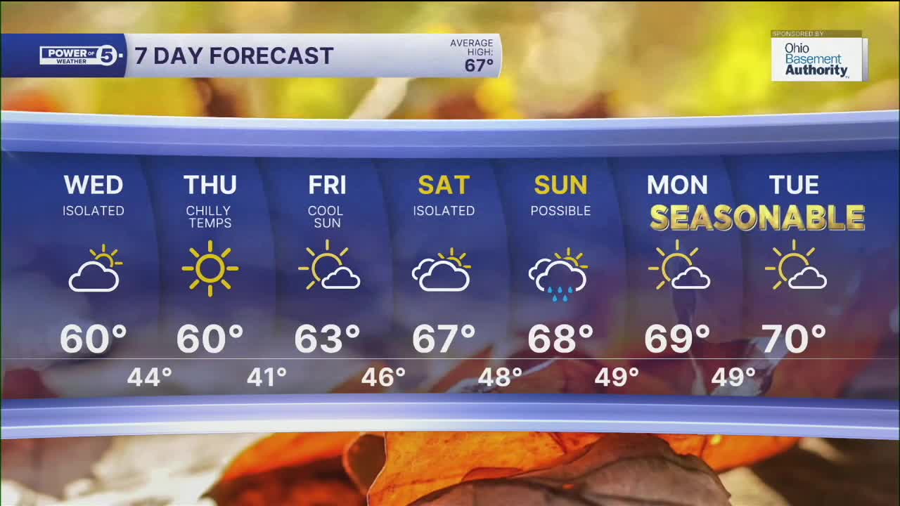
We will fall BELOW average for the next few days. Highs will struggle to reach the low 60s on Wednesday afternoon and fall to near 40 degrees on Thursday and Friday morning. The coldest morning looks to be Friday. Lows in the 30s along with patchy frost will be possible across our inland communities for the first time this season! Afternoon temperatures will slowly rise by this weekend, and it will be very typical for October with highs in the upper 60s and low 70s.
There will be plenty of dry time this weekend, but the latest data suggests a few showers cannot be ruled out both Saturday and Sunday. It is still several days out, so we will be sure to keep you posted on the likelihood of these showers and potential impacts to your plans.
DAILY FORECAST:
Tuesday Night: Drying up after midnight. Cooler temperatures. | Low: º
Wednesday: Drying early but staying chilly. | High: 58º
Thursday: Bright but still cool. | High: 60º
Friday: Seasonable.| High: 65º
Saturday: More clouds. | High: 68º
Want the latest Power of 5 weather team updates wherever you go? Download the News 5 App free now: Apple|Android
Click here to view our interactive radar.
Follow the News 5 Weather Team:
Trent Magill: Facebook & Twitter
Katie McGraw: Facebook & Twitter
Phil Sakal: Facebook & Twitter
Allan Nosoff: Facebook & Twitter
