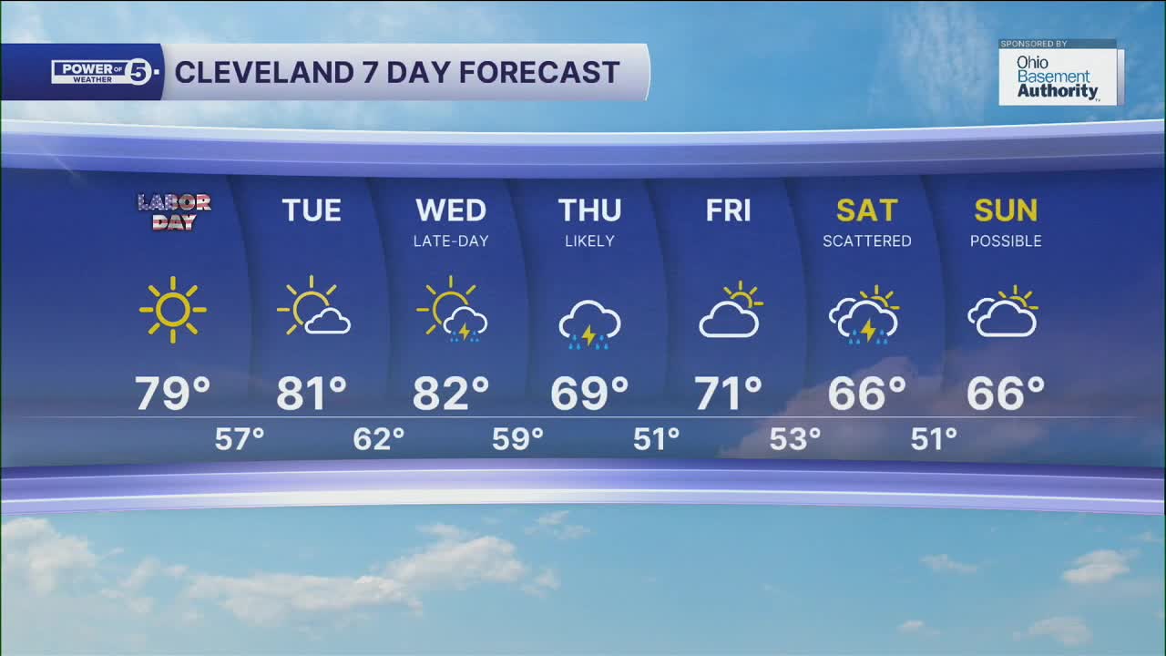


CLEVELAND — A picture-perfect weekend continues on Monday for Labor Day, with highs in the upper 70s and lower 80s, under mostly sunny skies. So get outside and enjoy the "Unofficial End to Summer", as it will be more fall-like for the end of the week.
Temperatures will warm a few more degrees through Wednesday, as highs will warm into the lower 80s across most of NEO. The last time we saw temperatures in the lower 80s was August 23rd.
Rain chances will begin to return late Wednesday through Thursday, as a cold front moves in. This will bring another shot of cooler air into the region to round out the week. Highs will drop from the lower 80s on Wednesday to the 60s Thursday through the weekend, except Friday.
Rain chances will drop off to round out the work week, but will increase for Saturday and may linger into Sunday.
DAILY FORECAST:
Labor Day: Seasonable sunshine! 10/10 day. | High: 79º
Tuesday: Touch warmer. More sunshine. | High: 82º
Wednesday: Warm. Storms late. | High: 82º
Thursday: Showers and Storms. Much cooler. | High: 69º
Friday: Mostly dry. More clouds. | High: 71º
Saturday: Rain chances return. Cooler. | High: 66º
Sunday: Rain possible. Cool. | High: 66º
Want the latest Power of 5 weather team updates wherever you go? Download the News 5 App free now: Apple|Android
Click here to view our interactive radar.
Follow the News 5 Weather Team:
Trent Magill: Facebook & Twitter
Katie McGraw: Facebook & Twitter
Phil Sakal: Facebook & Twitter
Allan Nosoff: Facebook & Twitter
