


CLEVELAND — Happy weekend! While it will be a dry weekend for most, the bigger weather story is the tale of two seasons, temperature-wise.
Rain ended by midnight, but clouds have remained overhead to start Saturday morning. The clouds will quickly clear by midday, and there will barely be a cloud in the sky during the afternoon and evening. Despite the abundant sunshine, it will be ineffective sunshine with the chilly north wind. Highs will struggle to even reach the upper 40s in Cleveland and along the lake.
50º or higher is expected for most spots south of I-80. Despite the warmer temps inland, it is nearly 10 degrees below average.
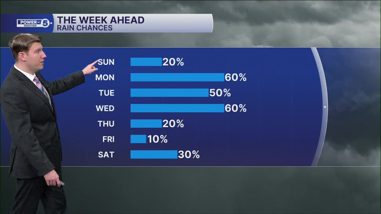
The cooldown is BRIEF, though! The warmth is surging back on Sunday. A few locations could even crest at 80 degrees by 5 p.m. with upper 70s for most. The warmth is expected for several days next week, which means it is our first sustained warmth of 2026. But — with the warmth comes the return of daily storm chances. Although each day has a chance for sporadic storms, it does not look like a washout every single day. The best chance for heavier rain is Monday morning and Tuesday night.
We will be watching for any stronger storms next week as well.
DAILY FORECAST:
Today: Cooler. Sunny afternoon.| High: 49°
Sunday: Warmer again. Partly cloudy. Isolated T-showers.| High: 79°
Monday: Morning rain. Afternoon storms.| High: 75°
Tuesday: PM storms possible. Humid.| High: 82°
Wednesday: Chance of storms. Humid.| High: 81°
Want the latest Power of 5 weather team updates wherever you go? Download the News 5 App free now: Apple|Android
Click here to view our interactive radar.
Follow the News 5 Weather Team:
Trent Magill: Facebook & Twitter
Katie McGraw: Facebook & Twitter
Phil Sakal: Facebook & Twitter
Allan Nosoff: Facebook & Twitter
