


CLEVELAND — Cold weather comes back for Christmas Day, typical December cold. Highs in the upper 30s to around 40 on Christmas Day. There will be no daytime travel concerns. There could be a few light passing showers between midnight and 5 a.m., but it clears out by daybreak.
Things change on Friday with the potential for a glaze of ice that could cause significant travel impacts. We'll be cold enough for snow at the surface but not in the clouds. That means melting snow that turns into rain will fall and freeze on the cold ground. Sleet and freezing rain are dangerous. Especially on a big travel day. The best chance for a few hours-worth of freezing rain would be in the higher elevations like the snowbelt on the east side, primarily Ashtabula County.
The ice will change to rain for everyone by midday, quickly ending the ice threat and improving road conditions. Still wet and slick, but at least not icy for the second half.
DAILY FORECAST:
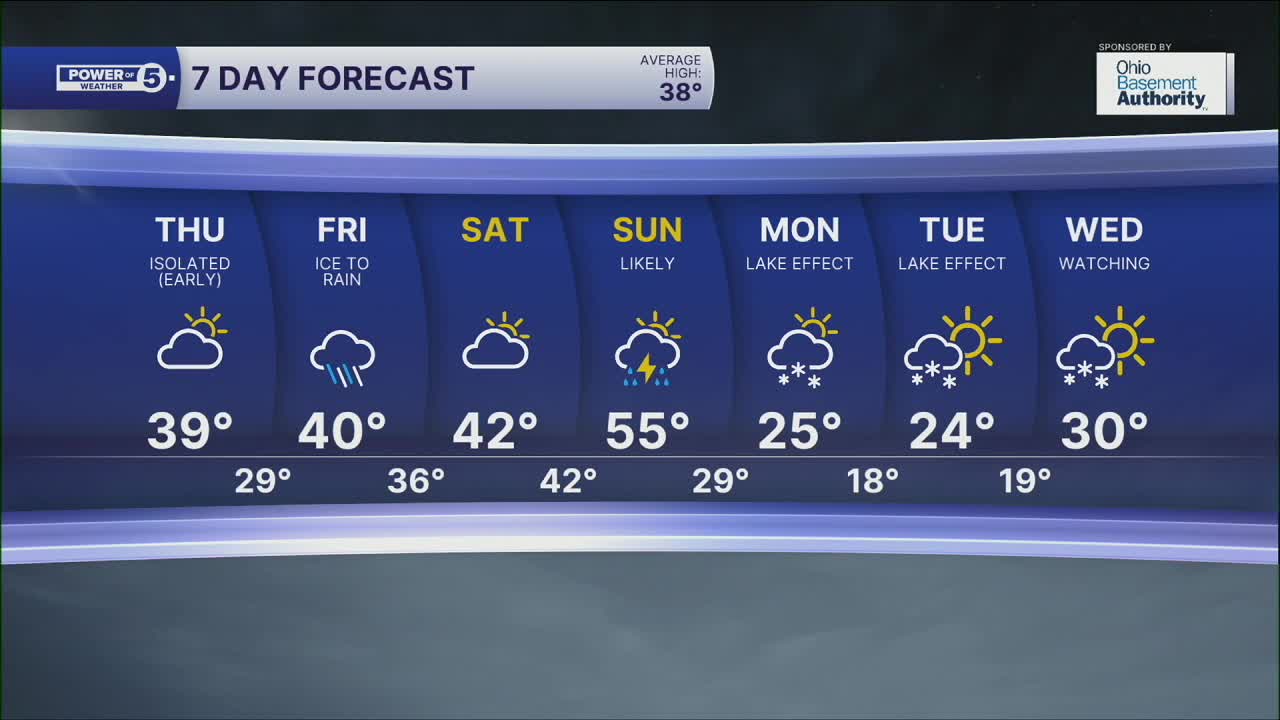
Christmas Day: Isolated morning showers. | High: 39º
Friday: Rain, freezing rain, and sleet all likely. | High: 40º
Saturday: Cool & dry. | High: 42º
Sunday: A few showers and t-storms possible. | High: 55º
Monday: Much colder. Lake effect snow possible. | High: 25º
Want the latest Power of 5 weather team updates wherever you go? Download the News 5 App free now: Apple|Android
Click here to view our interactive radar.
Follow the News 5 Weather Team:
Trent Magill: Facebook & Twitter
Katie McGraw: Facebook & Twitter
Phil Sakal: Facebook & Twitter
Allan Nosoff: Facebook & Twitter
