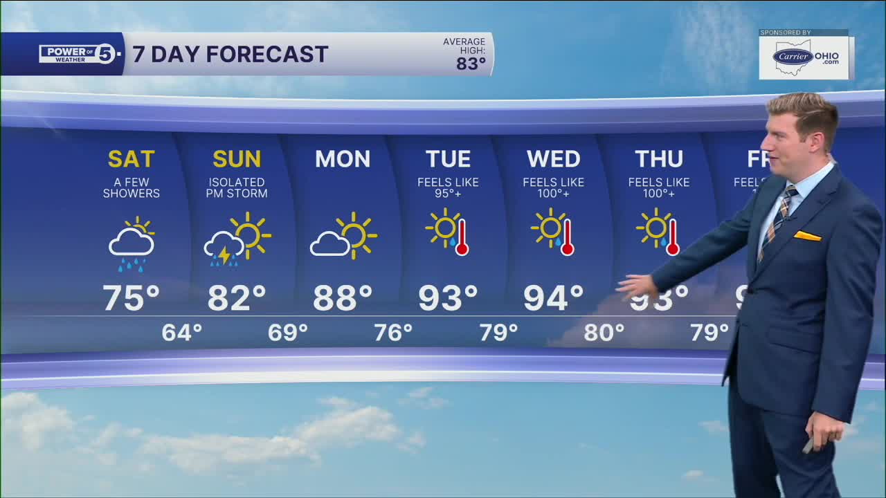


CLEVELAND — A few rain showers are crossing Northeast Ohio Saturday morning, and isolated showers are expected through early afternoon. Most areas will be dry for the 2nd half of Saturday, but remain mostly cloudy. Despite a few peeks of sun, especially lakeside, a cooler north wind will keep temperatures in check again. Highs will only be in the mid-70s, five-to-10 degrees below average.
The forecast for Sunday is not completely dry, but any pop-up downpours or storms look isolated, between 3 p.m. and sunset.
A major heat dome begins to build over the Ohio Valley into early next week. Temperatures surge from the 70s Saturday to the 80s Sunday, near 90 degrees on Monday, and into the 90s on Tuesday. Much more noticeable humidity also arrives alongside the heat. High heat + high humidity = dangerous heat. It will feel like triple digits for at least three straight days, something Northeast Ohio does not see often in any given summer.
The rain chance also looks to be slim next week, only isolated pop-ups because of the heat and humidity combination.
DAILY FORECAST:
Today: A few morning showers, isolated for the PM. Cool. High: 75º
Sunday: Partly cloudy. Isolated PM pop-up downpours. Warmer. High: 81º
Monday: Mostly sunny, hot and more humid. High: 88º, feels like 90º+
Tuesday: Sunny. Hazy, hot & humid. High: 93º, feels like 100º
Tuesday: Sunny. Hazy, hot & humid. High: 94º, feels like 100º+
Want the latest Power of 5 weather team updates wherever you go? Download the News 5 App free now: Apple|Android
Click here to view our interactive radar.
Follow the News 5 Weather Team:
Trent Magill: Facebook & Twitter
Katie McGraw: Facebook & Twitter
Phil Sakal: Facebook & Twitter
Allan Nosoff: Facebook & Twitter
