

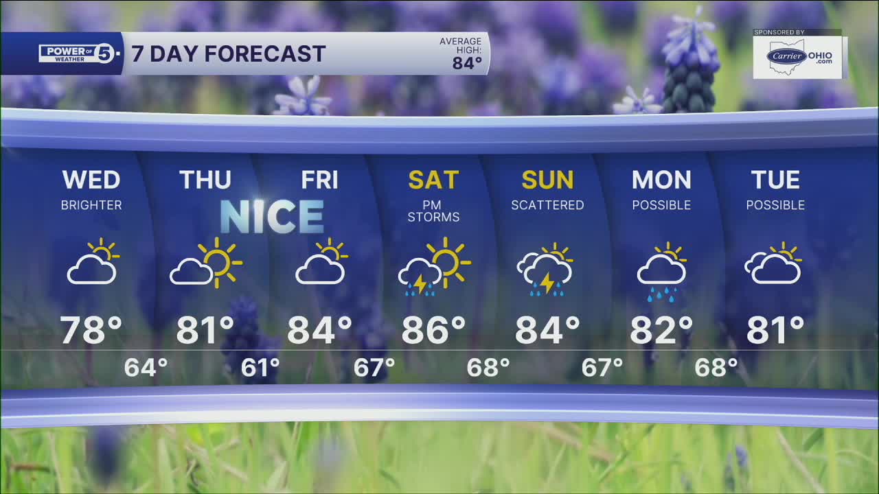


CLEVELAND — The biggest issue over the next day will be gusty winds. Northerly winds could gust over 25 mph at times. This will make Lake Erie dangerous tonight and all day Wednesday. There is a HIGH risk for rip currents. Stay out of the water. Waves will be 2 to 4 feet but could get as high as 4 to 7 feet in the nearshore waters.
And it may be tempting on Wednesday because it will be a much brighter and drier day with less humidity. We'll keep the north breeze around throughout the whole day. Expect plenty of sunshine and highs in the mid-70s, making for a great day to get outside otherwise. Winds will decrease by Thursday.
Summer warmth starts to build back in late week. Temps return to the 80s Thursday and Friday before our next chance for rain arrives over the weekend. As of Tuesday evening, it looks like rain chances will increase through the day on Saturday and continue into Sunday. While the weekend won't be a washout, keep an eye on the forecast if you have outdoor plans.
Power of 5 Region Spotlight: West Region
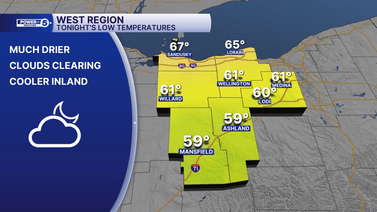
We are slowly clearing out tonight, but it will be most noticeable in our western communities first. Along the lakeshore, overnight lows will be in the mid 60s, but it will be cooler inland. For example, closer to the lake, near Sandusky, temperatures will be in the mid to upper 60s. Meanwhile, Ashland and Mansfield will be in the upper 50s. (This is true for other regions across NEO as well).
DAILY FORECAST:
Tuesday Night: Stray shower. Gusty winds. Decreasing clouds. | Low: 64º
Wednesday: Drier and breezy. Below average. | High: 76º
Thursday: Partly cloudy. Touch warmer. | High: 80º
Friday: Partly cloudy. Seasonable. | High: 83º
Saturday: More clouds. Shower possible. | High: 85º
Want the latest Power of 5 weather team updates wherever you go? Download the News 5 App free now: Apple|Android
Click here to view our interactive radar.
Follow the News 5 Weather Team:
Trent Magill: Facebook & Twitter
Katie McGraw: Facebook & Twitter
Phil Sakal: Facebook & Twitter
Allan Nosoff: Facebook & Twitter
