

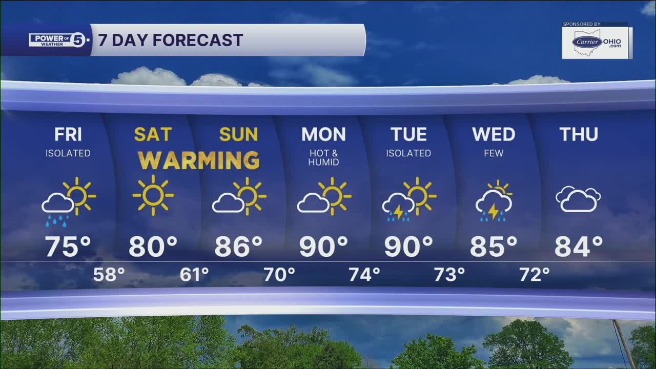


CLEVELAND — Random downpours are still in the forecast for the next 24 hours, but more than likely you will have pleasant weather for tonight and Friday. The weekend is looking wonderful...and warm!
CLE Metro & Snowbelt Regions Highlight: Browns forecast + Lunar Eclipse Cloudcast
The Browns forecast for the final preseason game looks WAYYYY better than the last preseason game last Saturday. (ICYMI...the game was delayed after only 2 minutes thanks to lightning and severe weather). CLE metro looks great for the next few hours, with mild temps falling into the mid-70s and upper 60s by midnight.
There is a lunar eclipse tonight! Peak viewing is shortly after midnight. The general forecast is partly cloudy, but a couple of downpours will be possible after midnight for CLE Metro and the Snowbelt around peak eclipse. I still think it is worth heading outside for a few minutes to check it out!
As those downpours roll in, a few waterspouts will be possible on Lake Erie tonight and into Friday morning.
Looking ahead:
A stray storm and downpour will still be possible on Friday, but there is a much better chance to stay dry across all of NEO. It will be a little bit cooler on Friday, with temperatures in the mid 70s, but that does not last long. Get ready to sweat!
Warmer temps and more humidity return by the end of the weekend. We jump 5 degrees from Friday to Saturday, another 5 by Sunday, and ANOTHER 5 by Monday! Temperatures are expected to climb to near 90 degrees for the start of September! The weekend is also looking dry. Storm chances should ramp up by the middle of next week.
5-Day Forecast
Tonight: Isolated downpours. Mild temps | Low: 66º
Friday: Isolated shower/thunder. Cool for August. | High: 75º
Saturday: Sun, cloud mix, warm & dry. | High: 80º
Sunday: Sun, cloud mix, warmer & dry. | High: 85º
Monday: Partly sunny. Hot and humid. Feels like mid-90s. | High: 90º
Learn the lingo: The Power of 5 Weather Team wants to get you your forecast closer to home. We have broken NEO into 5 separate and distinct regions. Find your region to get your hyper-local forecast!
- Cleveland Metro Region: Cuyahoga County. This region includes cities such as Cleveland, Parma, Westlake, Berea, Strongsville, Independence, Solon, Beachwood, and Euclid.
- Snowbelt Region: Lake, Geauga, and Ashtabula Counties. This includes cities such as Mentor, Geneva, Ashtabula, Bainbridge, Chardon, Burton, and Orwell.
- Akron-Canton Region: Summit, Stark, and Portage Counties. This region includes cities such as Akron, Canton, Hudson, Ravenna, Mantua, Alliance, and Canal Fulton.
- West Region: Lorain, Medina, Erie, Huron, Richland, and Ashland Counties. This region includes cities such as Lorain, Wellington, Medina, Lodi, Ashland, Mansfield, Willard, and Sandusky.
- South Region: Wayne, Holmes, Tuscarawas, Carroll Counties. This region includes Wooster, Millersburg, New Philadelphia, Strasburg, Mineral City, Carrollton, and Newcomerstown
Want the latest Power of 5 weather team updates wherever you go? Download the News 5 App free now: Apple|Android
Click here to view our interactive radar.
Follow the News 5 Weather Team:
Trent Magill: Facebook & Twitter
Katie McGraw: Facebook & Twitter
Phil Sakal: Facebook & Twitter
Allan Nosoff: Facebook & Twitter
