


CLEVELAND — Frigid temperatures will linger through the evening across Northeast Ohio, with wind chills in the Single Digits. So layer up if you venture out.
Skies will become partly cloudy during the overnight hours. Lows will be in the lower Teens and Single Digits for many across NEO.
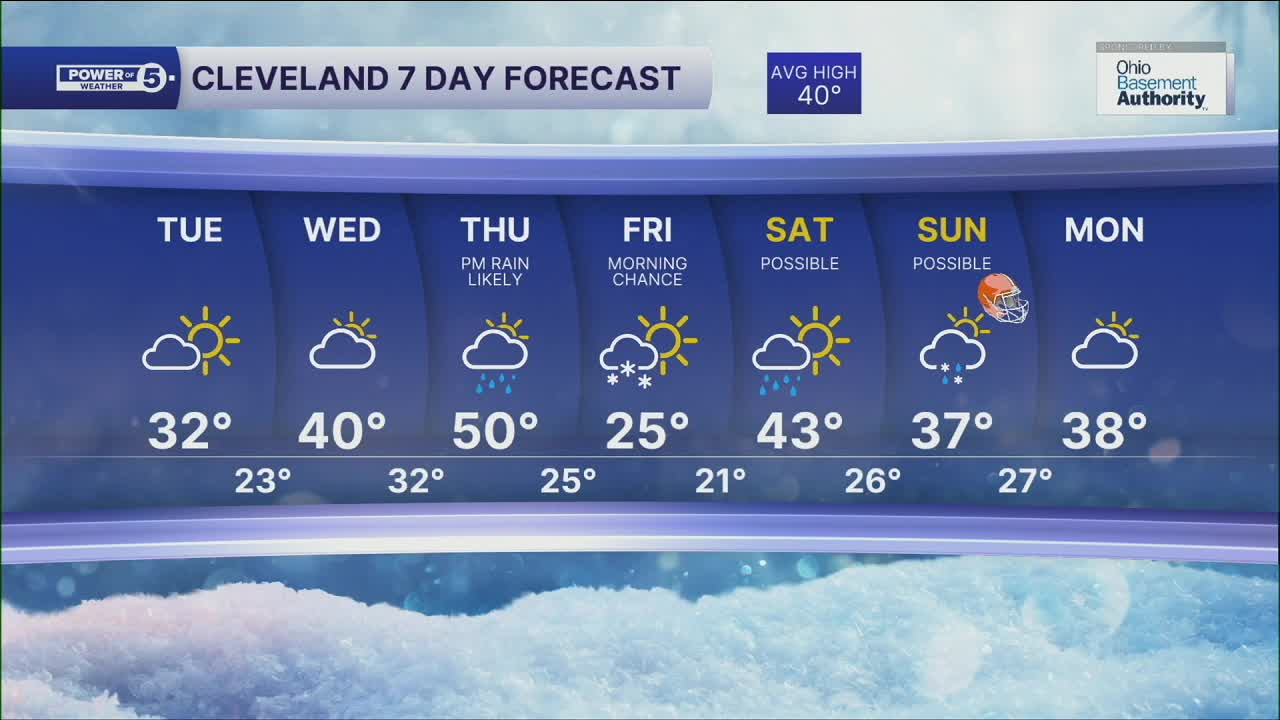
If you're looking for a thaw... be patient. It's finally showing up during the midweek. A massive area of high pressure will bring warmer weather to three-quarters of the country by the end of this week. We'll be on the northern edge, so the 40s will return by Wednesday, and close to 50° will be possible on Thursday! There will be more rain on Thursday, mainly during the afternoon, with the warmer air surging in. Thunder could be possible.
Colder temperatures will move back in for Friday, before we see more above-freezing temperatures. Rain and or rain/snow mix will be possible, especially on Sunday.
DAILY FORECAST:
Tuesday: Clouds and sun. Warmer. | High: 32º
Wednesday: Shower possible late. Warmer. | High: 40º
Thursday: PM Rain showers. Warm & Breezy. | High: 50º
Friday: Few Snow Showers. Colder Again. Breezy. | High: 25º
Saturday: Showers Possible. Warming. | High: 40º
Sunday: Rain/Snow Possible. Chilly. | High: 37º
Want the latest Power of 5 weather team updates wherever you go? Download the News 5 App free now: Apple|Android
Click here to view our interactive radar.
Follow the News 5 Weather Team:
Trent Magill: Facebook & Twitter
Katie McGraw: Facebook & Twitter
Phil Sakal: Facebook & Twitter
Allan Nosoff: Facebook & Twitter
