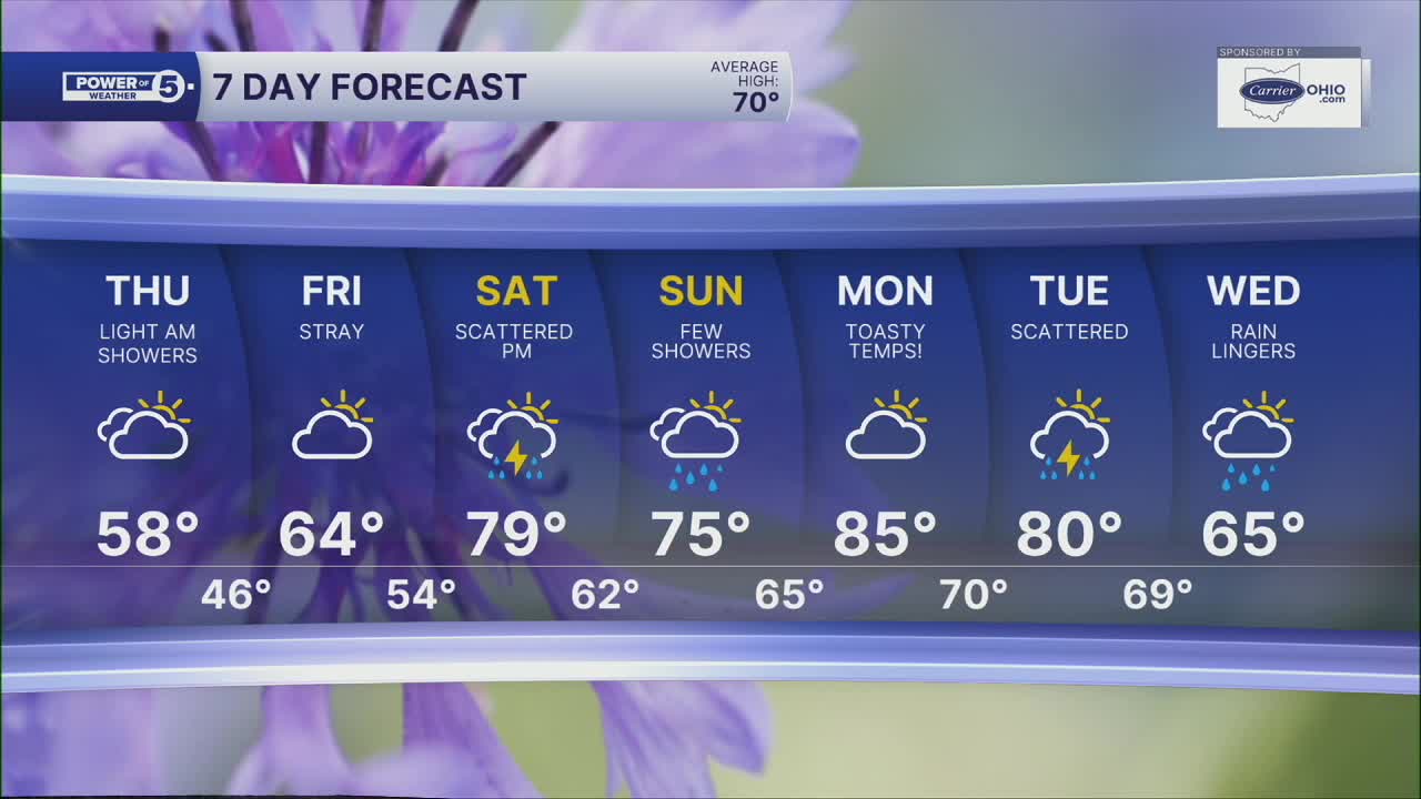


CLEVELAND — The chill lingers on across NEO. In fact, temperatures will remain below average through Friday.
Lows overnight and out the door Thursday morning will be in the low to mid 40s. It will be cloudy too with a couple of light showers. It will also remain breezy with winds gusting over 20 mph at times. Keep the jacket close by tonight and tomorrow, too!
Highs will only be in the upper 50s and low 60s again on Thursday, which is running about 10 degrees below average. A few more isolated showers are possible Thursday morning before we dry out and clear out.
Slowly but surely, temperatures will begin to rise. The heat really ramps up by this weekend and early next week. Highs will be nearing 80 this weekend, and well into the 80s by Monday! The warmth will likely make everyone want to get outside this weekend, but we will have to listen for thunder and dodge a few storms Saturday afternoon and evening.
DAILY FORECAST:
Wednesday Night: Cool, cloudy, stray showers. | Low: 44º
Thursday: Mostly cloudy, isolated showers possible early, then decreasing clouds. | High: 60º
Friday: Partly cloudy. Still below the norm, but slightly milder. | High: 65º
Saturday: Warm & breezy with scattered PM storms. | High: 76º
Sunday: A few t-showers possible, very warm. | High: 79º
Monday: Heat building with a slim shot at thunder. | High: 85º
Want the latest Power of 5 weather team updates wherever you go? Download the News 5 App free now: Apple|Android
Click here to view our interactive radar.
Follow the News 5 Weather Team:
Trent Magill: Facebook & Twitter
Katie McGraw: Facebook & Twitter
Phil Sakal: Facebook & Twitter
Allan Nosoff: Facebook & Twitter
