


CLEVELAND — We are finally dry with decreasing clouds! Clouds will take the longest to clear in our far northeastern communities, but everyone is expected to be mostly clear overnight. There is another chance to see the northern lights, so with fewer clouds, it is worth a look!
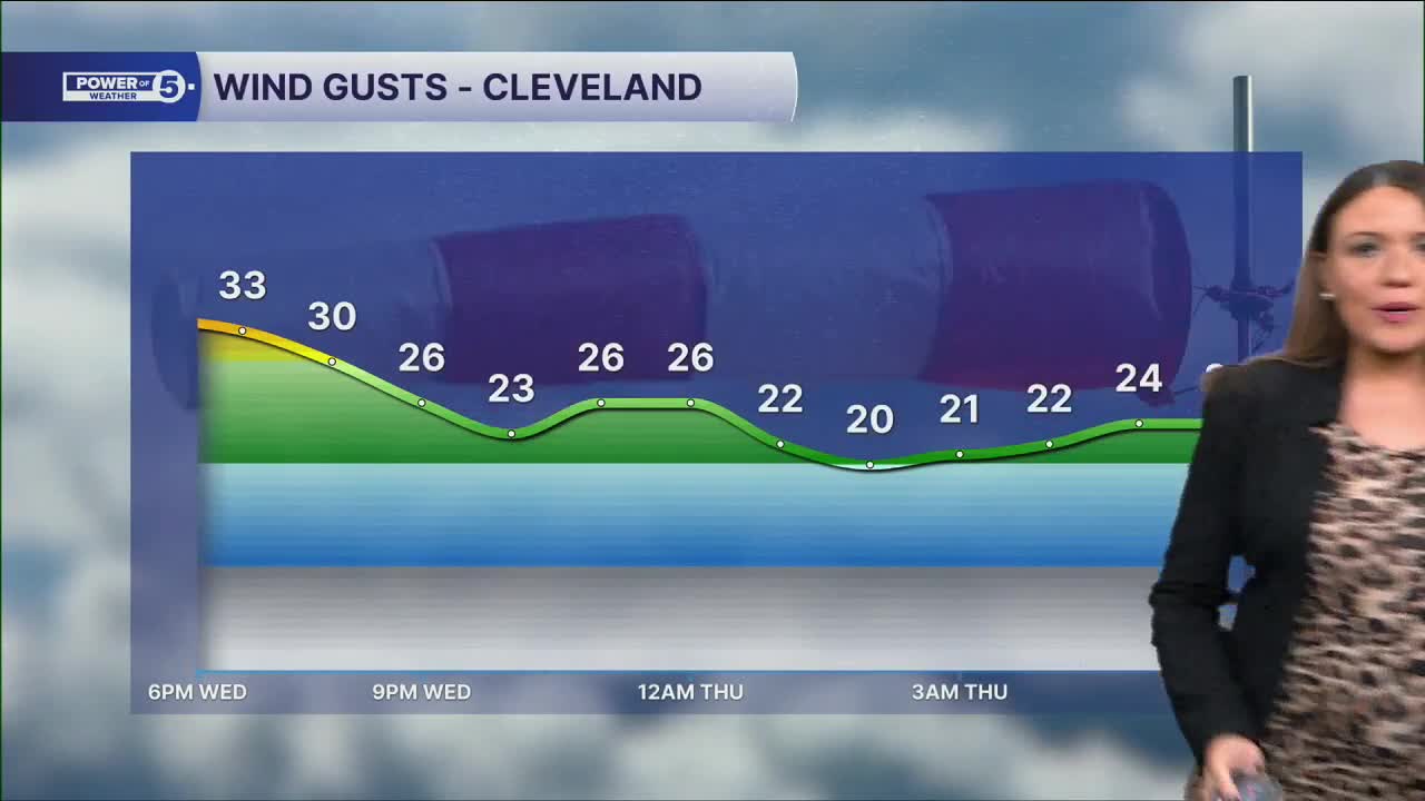
It has been pretty windy, and it will remain breezy overnight and into Thursday. Plan for westerly winds 10-20 mph and gusts to 25 mph tonight. With temperatures in the 30s, it will feel even colder! So grab the coat as you venture outdoors Thursday morning. Westerly winds will gradually decrease throughout the day tomorrow.
We're dry and mild again Thursday with 40s followed by 50s Friday and another dry day. We may even squeeze out 60º Saturday before the drop comes back on Sunday.
Plan on a few showers by Saturday afternoon and evening. These will likely continue Sunday, but should exit pretty early in the day, and will be followed by a quick drop into the 40s. The temperatures will eventually drop into the 30s overnight into Monday. Next week is looking chilly and below average, with highs only in the 40s most days.
DAILY FORECAST:
Wednesday Night: Fewer clouds, cold and breezy. | Low: 36º
Thursday: Dry. Partly sunny. | High: 47º
Friday: Partly sunny. Seasonable. | High: 52º
Saturday: Mostly cloudy. Warm. Few PM showers.| High: 63º
Sunday: Isolated showers, mainly early and east. Colder.| High: 63º
Want the latest Power of 5 weather team updates wherever you go? Download the News 5 App free now: Apple|Android
Click here to view our interactive radar.
Follow the News 5 Weather Team:
Trent Magill: Facebook & Twitter
Katie McGraw: Facebook & Twitter
Phil Sakal: Facebook & Twitter
Allan Nosoff: Facebook & Twitter
