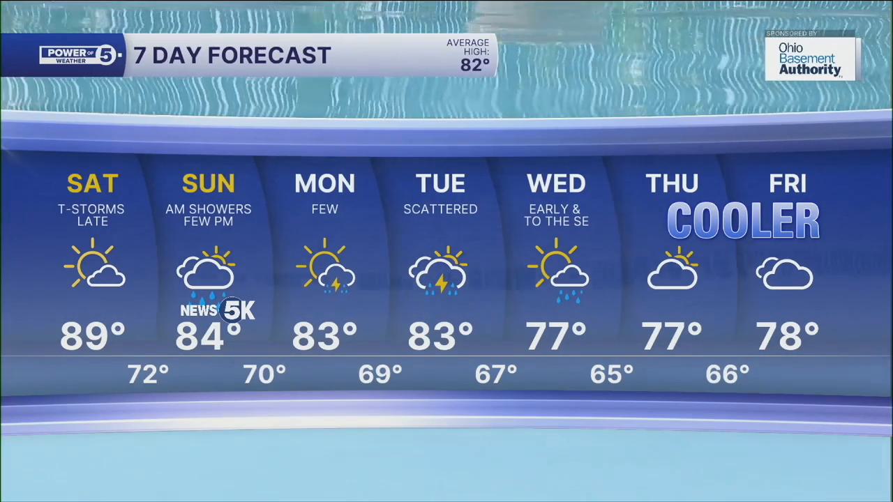


CLEVELAND — It will be dry for most of Saturday, which will allow heat and humidity to make a comeback to NEO. Temperatures will warm to around 90 degrees again this weekend, and with higher humidity, it will feel even warmer! The heat index values will be in the mid-90s on Saturday afternoon.
There will be plenty of dry time this weekend, but a couple of storms look possible by Saturday night into early Sunday. Keep this in mind if you are planning on going to the News 5k Sunday morning! A few hit-and-miss t-showers will also be on Sunday afternoon and evening.
The storm threat should drop a bit on Monday, before increasing again on Tuesday. These storms appear to usher in a pattern change for the middle of next week, as cooler air returns to NEO...highs could be in the SEVENTIES by the middle of the week! However, these storms could also be strong or severe. It is still a few days out, so be sure to stay tuned for the latest updates as we get a clearer picture regarding timing and coverage of storms next week.
DAILY FORECAST:
Friday Night: Clear, warm, and quiet.| Low: 68º
Saturday: Hot and humid. More sunshine. T-showers late. | High: 89º
Sunday: More humid with a few storms. | High: 85º
Monday: Humid again with a few storm chances. | High: 86º
Want the latest Power of 5 weather team updates wherever you go? Download the News 5 App free now: Apple|Android
Click here to view our interactive radar.
Follow the News 5 Weather Team:
Trent Magill: Facebook & Twitter
Katie McGraw: Facebook & Twitter
Phil Sakal: Facebook & Twitter
Allan Nosoff: Facebook & Twitter
