



CLEVELAND —
Storms Return Saturday...
Friday was fabulous! It's the kind of weather that makes you want to spend every minute outside. Much of NEO stays dry until Saturday. We need to plan for rounds of showers and storms on Saturday. A few storms could become strong or severe during the afternoon and evening.
Power of 5 Spotlight: West Region
The vast majority of us remain dry until rain returns Saturday. However, a brief pop-up shower or thunderstorm can't be ruled out this evening or overnight, especially across the West Region. It does not look like these storms will be strong or severe, but they could bring brief heavy rainfall and rumbles of thunder. These look to weaken overnight as they continue to move east. By Saturday morning, additional showers and storms will head toward the West Region and continue to impact the rest of NEO.
Stay alert on Saturday...
If you're heading to the Browns' preseason game with a 1 p.m. kickoff, make sure to keep an eye on the forecast. This is true for any outdoor plans you may have tomorrow. Rain and thunderstorms are expected to build into Northeast Ohio around midday, potentially impacting portions of the game.
Outdoor sporting events become dangerous quickly when thunderstorms approach. If thunder roars, head indoors immediately. Lightning can strike miles away from the storm itself, and heavy downpours can reduce visibility in the stands and on area roadways. Gusty winds may also create hazards for tailgaters and fans carrying tents, umbrellas, or other loose items.
Temperatures will be around 80 degrees. It does not look like it will rain all day, but there could be 2 to 3 rounds of showers and thunderstorms. How the morning round of thunderstorms plays out will dictate how strong storms can become during the afternoon and evening. We will be watching for potentially damaging winds and hail along with heavy rain and lightning. The
Keep weather alerts enabled on your phone and be prepared to move to shelter if warnings are issued.
Looking ahead: Drier and cooler
Saturday storms are being brought to us by a cold front. That front will cross through NEO this weekend and drop our temperatures 5-10 degrees between Saturday and Sunday. There will be a few lingering showers on Sunday, but there should be a lot more dry time compared to Saturday.
Below-average temperatures will linger into the work week. Highs on Monday could be in the low 70s! It will be comfortable and dry until mid-week. The taste of fall does not last too long... we will be back into the upper 70s and low 80s by the end of the week, along with renewed storm chances.
5-Day Forecast
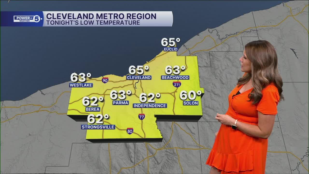
Friday Night: Variable clouds. A stray storm west. | Low: 65º
Saturday: Scattered rain arriving midday. | High: 80º
Sunday: A few lingering Showers. Cooler temps.| High: 73º
Monday: Cool temperatures. Sun and clouds. | High: 71º
Tuesday: More sun, Comfortable. | High: 76º
Learn the lingo: The Power of 5 Weather Team wants to get you your forecast closer to home. We have broken NEO into 5 separate and distinct regions. Find your region to get your hyper-local forecast!
- Cleveland Metro Region: Cuyahoga County. This region includes cities such as Cleveland, Parma, Westlake, Berea, Strongsville, Independence, Solon, Beachwood, and Euclid.
- Snowbelt Region: Lake, Geauga, and Ashtabula Counties. This includes cities such as Mentor, Geneva, Ashtabula, Bainbridge, Chardon, Burton, and Orwell.
- Akron-Canton Region: Summit, Stark, and Portage Counties. This region includes cities such as Akron, Canton, Hudson, Ravenna, Mantua, Alliance, and Canal Fulton.
- West Region: Lorain, Medina, Erie, Huron, Richland, and Ashland Counties. This region includes cities such as Lorain, Wellington, Medina, Lodi, Ashland, Mansfield, Willard, and Sandusky.
- South Region: Wayne, Holmes, Tuscarawas, Carroll Counties. This region includes Wooster, Millersburg, New Philadelphia, Strasburg, Mineral City, Carrollton, and Newcomerstown
Want the latest Power of 5 weather team updates wherever you go? Download the News 5 App free now: Apple|Android
Click here to view our interactive radar.
Follow the News 5 Weather Team:
Trent Magill: Facebook & Twitter
Katie McGraw: Facebook & Twitter
Phil Sakal: Facebook & Twitter
Allan Nosoff: Facebook & Twitter
