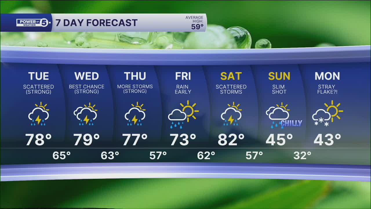


CLEVELAND — Feeling much more like June, rather than mid-April across Northeast Ohio, but we will have to dodge rounds of storms.
Temperatures will only fall back into the lower 60s for most of the area tonight. Most of the storms should exit around 12 - 2 am, although a few could linger in our northernmost communities overnight and into Tuesday morning.
More storms are expected tomorrow, too! On and off storms will continue for much of this week. How tonight's storms unfold dictates tomorrow's storms, and tomorrow's storms dictate Wednesday and so forth.
Tomorrow's forecast will be similar to today's, including temperatures around 80 degrees with scattered storms expected. Strong to severe storms will be possible starting as soon as the late morning to early afternoon into the evening.
Wednesday looks like the most active day this week in storm coverage. They'll likely be the strongest we see all week, also.
We'll watch for timing and update you as soon as we get a handle on them. Similar story for Thursday—plan on storms, but not all day.
DAILY FORECAST:
Tonight: Warm & breezy. Spotty storms.| Low: 63°
Tuesday: Scattered storms. Humid.| High: 78°
Wednesday: Scattered storms. Humid.| High: 78°
Thursday: More storms are possible. | High: 78°
Friday: Showers early. Still mild. | High: 74º
Want the latest Power of 5 weather team updates wherever you go? Download the News 5 App free now: Apple|Android
Click here to view our interactive radar.
Follow the News 5 Weather Team:
Trent Magill: Facebook & Twitter
Katie McGraw: Facebook & Twitter
Phil Sakal: Facebook & Twitter
Allan Nosoff: Facebook & Twitter
