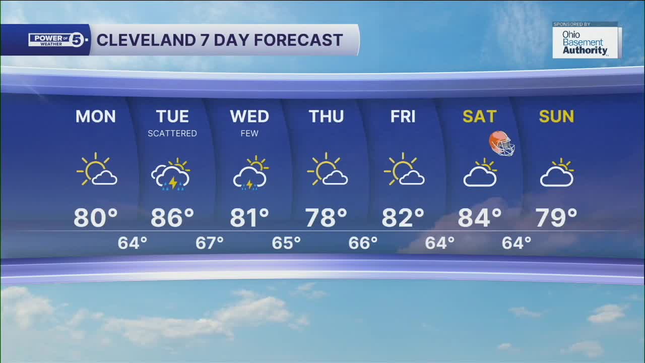


CLEVELAND — A beautiful start to the work week, with more sunshine and seasonal temperatures. Highs will be cooler along the lakeshore, but most will top off in the low to mid 80s Monday afternoon.
More rain moves in for the day on Tuesday, along with warmer temperatures. We'll need to keep an eye on Tuesday for the threat of stronger storms as a front moves through.
As we head into the end of the week, we can expect more refreshing air to move in. Temperatures will top off in the mid to upper 70s by Wednesday, along with lower humidity once again! This will continue into the end of the week, along with more sunshine on Thursday and Friday!
DAILY FORECAST:
Monday: Mostly dry. Humid. | High: 80º
Tuesday: Scattered showers, Few storms. Humid. | High: 86º
Wednesday: Few t'showers. Cooler and less humid. | High: 81º
Thursday: Mostly sunny and pleasant. | High: 78º
Friday: Mostly sunny and warmer. | High: 82º
Saturday: Mostly dry. Touch warmer. | High: 84º
Want the latest Power of 5 weather team updates wherever you go? Download the News 5 App free now: Apple|Android
Click here to view our interactive radar.
Follow the News 5 Weather Team:
Trent Magill: Facebook & Twitter
Katie McGraw: Facebook & Twitter
Phil Sakal: Facebook & Twitter
Allan Nosoff: Facebook & Twitter
